OGRE CITY HILLS
Although at first glance the terrain may seem quite flat when arriving in Ogre, a closer look reveals both larger and smaller hills. In the press of the 1930s, Ogre was even compared to Davos in Switzerland. The picturesque hills were one of the reasons why, in the 19th century, Ogre became a popular resort. […]
Although at first glance the terrain may seem quite flat when arriving in Ogre, a closer look reveals both larger and smaller hills. In the press of the 1930s, Ogre was even compared to Davos in Switzerland. The picturesque hills were one of the reasons why, in the 19th century, Ogre became a popular resort. The hills provided shelter from the wind, and their sandy soil easily absorbed moisture, helping to dry the air. The favourable climatic conditions, the scent of conifers, and the silence of the forest attracted Riga residents who were tired of the bustle of city life. Since the city’s beginnings, the hills have served as walking areas offering beautiful views, and in ancient times, they were used as fortifications.
The Ogre hills, or Kangari, were formed approximately 12,000 years ago, when a glacier 1–2 kilometres thick covered this area. As it melted, water currents created deposits of pebbles and sand, which geologists call eskers. In Swedish, this word is written “ås” and pronounced [o:s]. In Latvian, it means “ridge”. The word “kangari” comes from the Livonian (Līvu) word “kāngar”, pronounced [ka:ngar], which also means “ridge” or “rampart”. According to legend, the glacier transformed into a giant who carried bags of sand to Riga, but sand spilled from a hole in the bag, forming the hills.
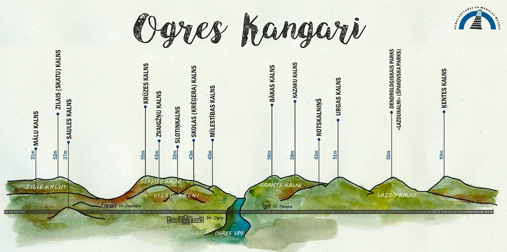
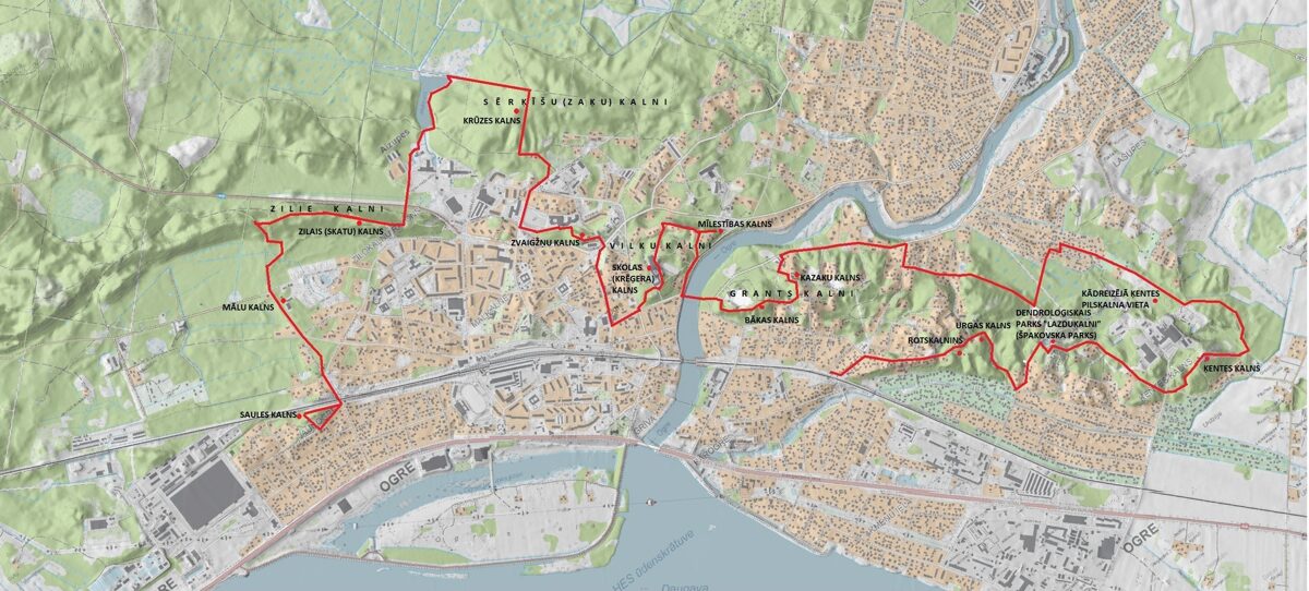
The Ogre Kangari within the city consists of several hill ranges. In Pārogre, there are Ķentes Hill, the Lazdu Hills (Hazel Hills), and Grantskalni (Gravel-hills); in the central part of Ogre, there are the Vilku Hills (Wolf Hills) and Sērķīšu Hills; and in Jaunogre, there are the Zilie Hills (Blue Hills), which extend as far as Ikšķile and Tīnūži, where they continue as the Liepu Hills (Linden Hills). Each of these hill ranges also includes individual peaks with their own names and historical stories.
PĀROGRE
ĶENTES HILL
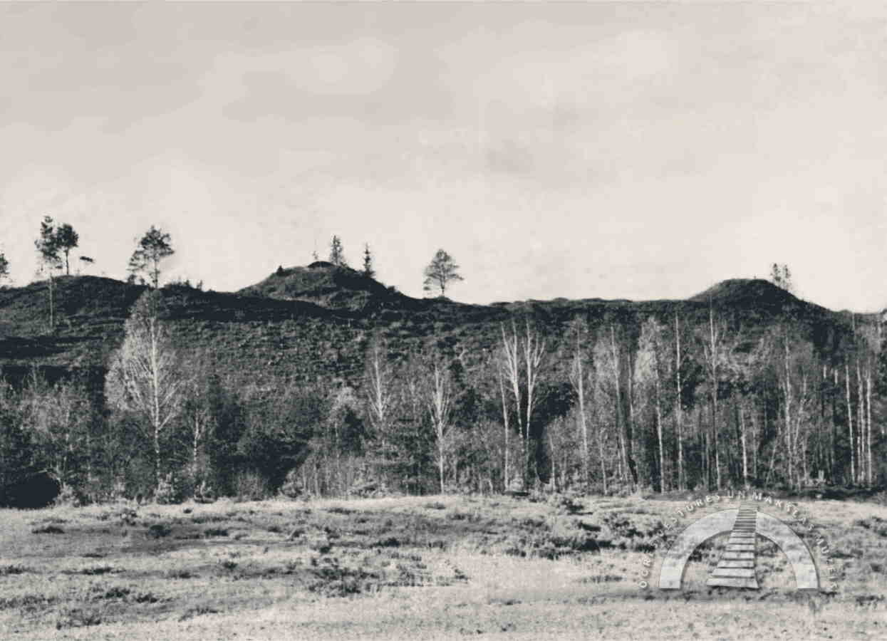
In the eastern part of Ogre, near present-day Ķentes Street, there was once a hill range known as Ķentes Hill, which existed until the 1950s. The highest point of the hill reached 69 metres above sea level, and it was said that even the towers of Riga could be seen from its summit. Various literary sources mention several names for the hill: Ķenckalns, Ķences kalns, Ķenču kalns, Kanča kalns, and Ķēniņu kalns (King’s hill). In legend, it was also associated with ancient Riga. The first summer visitors to Ogre called it the Peak of Three Emperors (German: Drei Kaiser Spitzen) or Camel’s Back (German: Kameelsrücken), as three conical, artificially formed peaks once stood side by side.
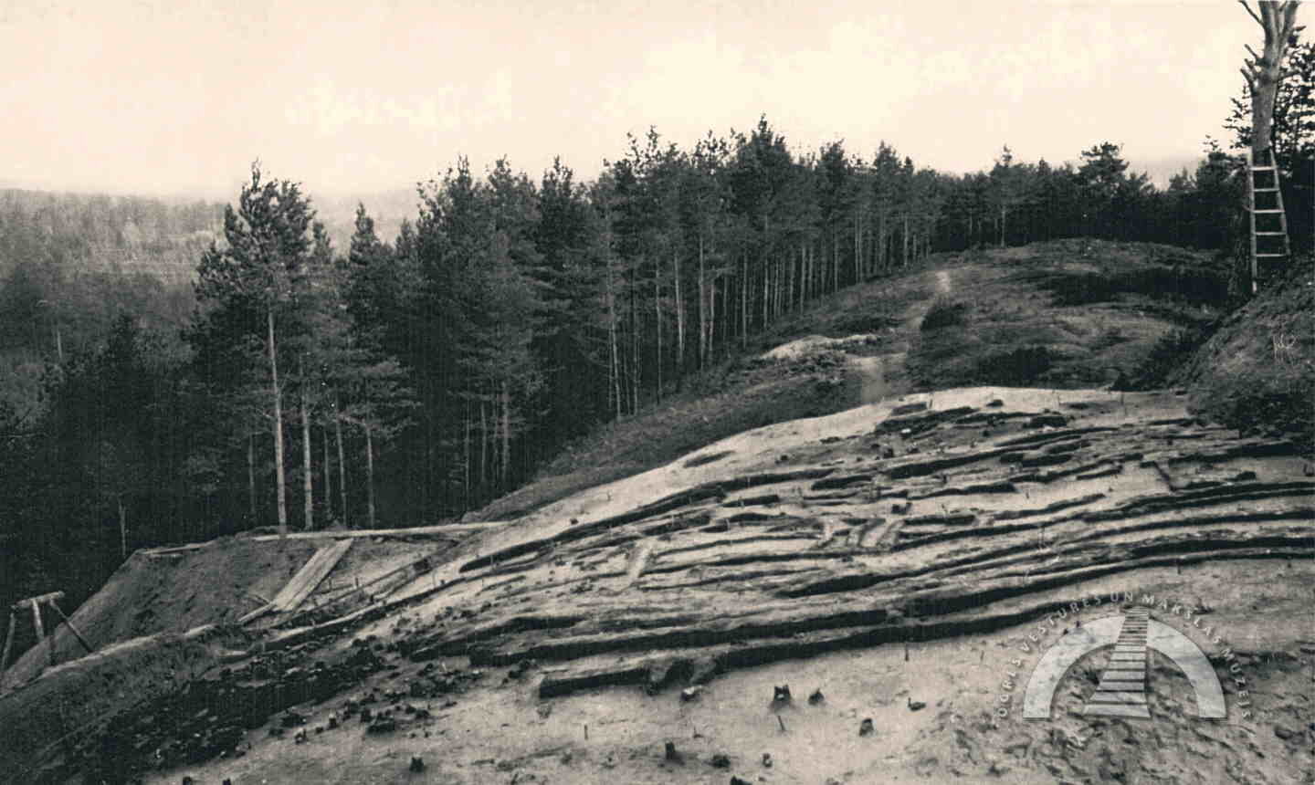
In the second half of the 19th century, Ķentes Hill attracted the interest of historians. Initial small-scale excavations took place in the 1880s, followed by extensive archaeological excavations and topographical measurements between 1954 and 1958. These works were carried out before the hill was quarried for gravel. Excavations were conducted both in the hillfort area discovered on Ķentes Hill and at its foot, where a settlement had once existed. The oldest artefacts found – flint tools – date to 9500–8300 BC and indicate that reindeer hunters temporarily stayed on the hill long before the hillfort was established. A fortified settlement was created here in the 1st millennium BC. The hillfort’s most prosperous period was between the 5th and 9th centuries, when it became an important centre in the lower Daugava region. During this time, it was destroyed three times. In the 9th century, the hillfort was abandoned.
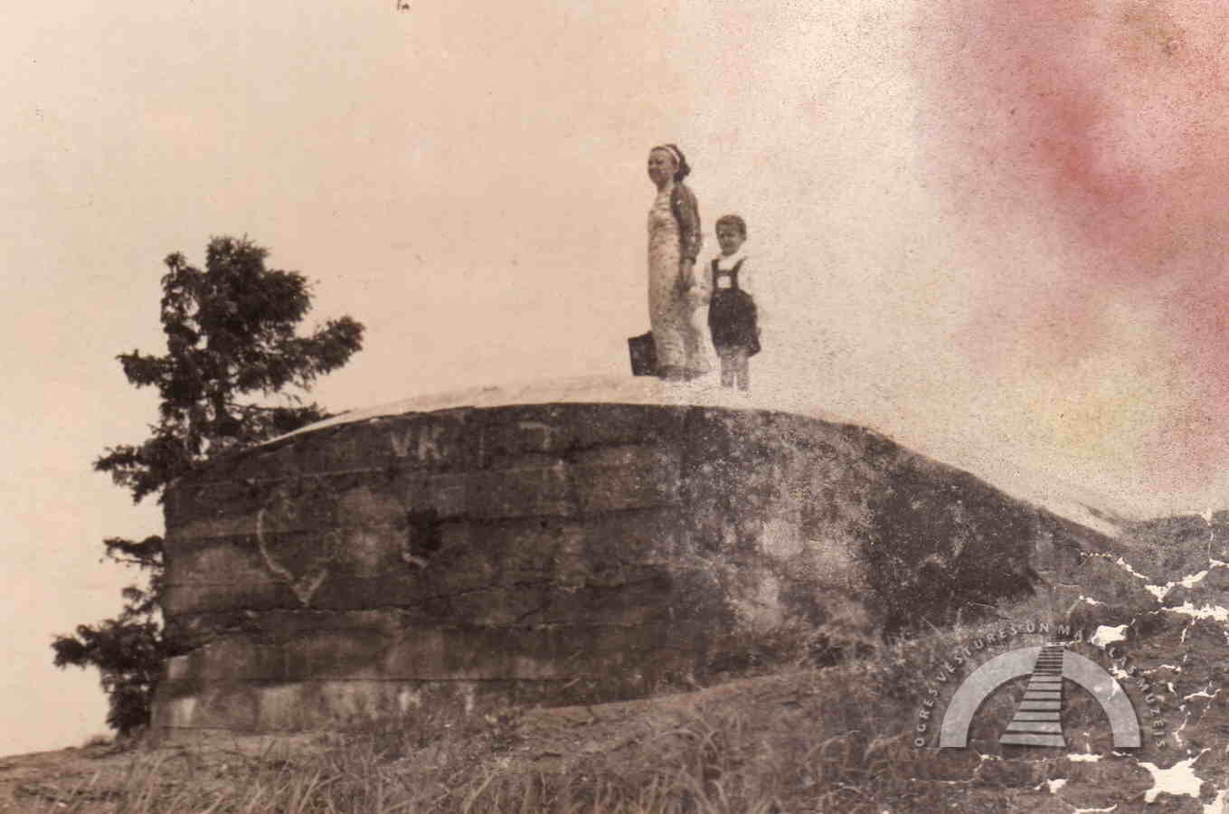
During World War I, the Russian army built a concrete blindage (bunker) on one of the hillfort’s ramparts, and trenches were dug across the hill. As the city of Ogre developed, Ķentes Hill became a popular walking area, and many photographs from that time have been preserved.
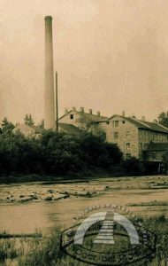
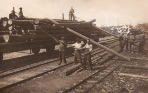
During the Soviet occupation, the city’s development priorities changed significantly. In 1953, a gravel quarry was established near the hillfort, and over the following decade, the hill was gradually excavated. A silicate brick factory was built on the site, later followed by the Ogre Building Plastics Factory. In January 1970, a luge track was opened on the south-eastern slope of Ķentes Hill, which had survived the main excavation works. The track was 275 metres long, and a water pipeline ran along its entire length, allowing a high-quality ice surface to be created. After the artificial ice track in Sigulda opened in 1986, the Ogre luge track was no longer used. In the 1980s, a slalom track was established on the southern edge of the former Ķentes Hill, with a starting point built up to a height of 63 metres.
LAZDU HILLS AND GRANTSKALNI
Between Ķentes Hill and the Ogre River lie Lazdu Hills and Grantskalni. In Lazdu Hills is the Špakovskis Dendrological Park “Lazdukalni”, created by Jānis and Benita Špakovskis. At the beginning of the 20th century, a small manor called “Mariņmuiža” (German: Marinhaus) was located in this area, where the Mīlbergs family lived. The manor was destroyed during World War I, and its owners left for Germany. Afterwards, the property became overgrown with bushes and trees.
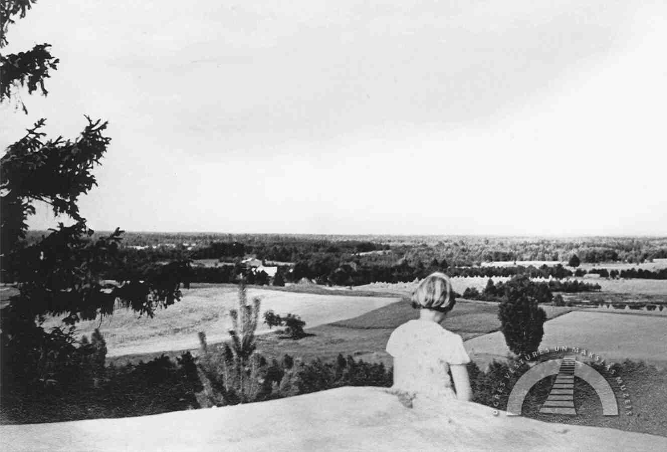
The idea of creating a park came to the Špakovskis family in 1975. The wooded area had to be cleared, and gradually various valuable tree species were planted, including red oaks, hornbeams, walnuts, Murray pines, and ginkgo trees. In 1993, by decision of the Ogre City Council, the dendrological park was granted the status of an object of public importance. Today, the park features more than 400 species of shrubs and trees from Western Europe, Siberia, the Far East, and the Pacific coast. A viewing tower stands at the highest point of the park.
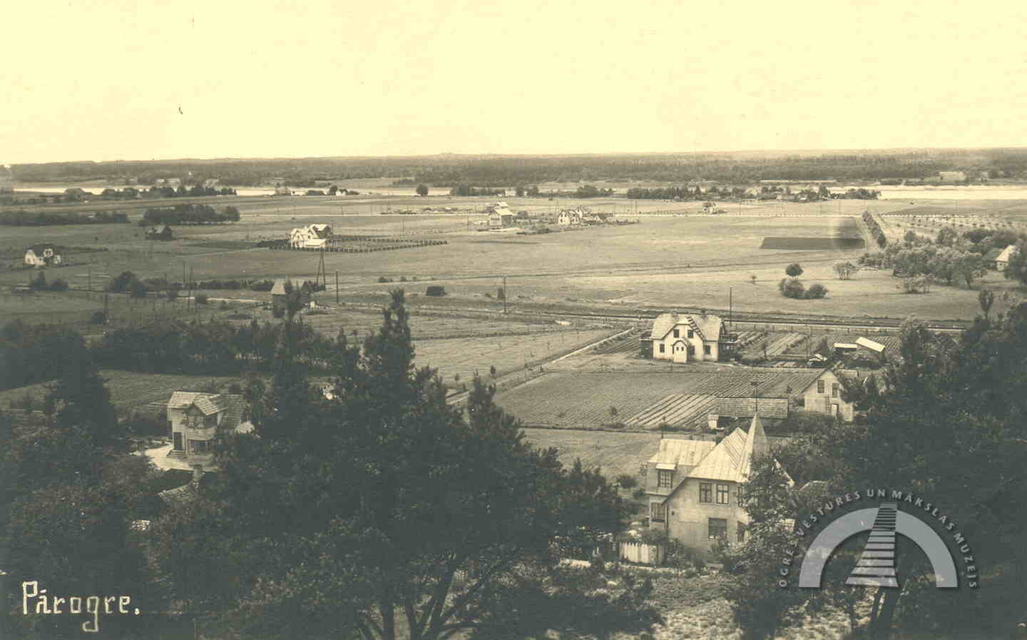
Near Pārogre station, next to the Urga stream, is Urgas Hill. During the Soviet era, a Pioneer campsite was established at the top of the hill. Slightly lower, at the intersection of Andreja and Indrānu Streets, is Rotskalniņš, where a memorial plaque was unveiled in 1978 to commemorate the Ikšķile parish people’s assembly held on 31 October 1905. During the Soviet occupation, a bomb shelter for the Baltic Railway command post was also located nearby.
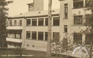
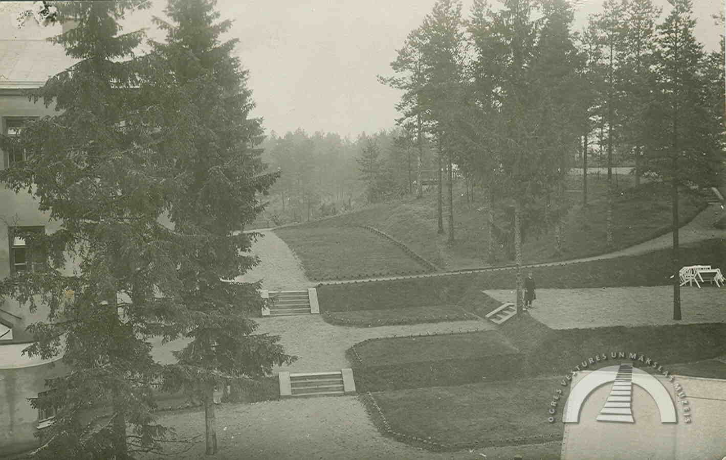
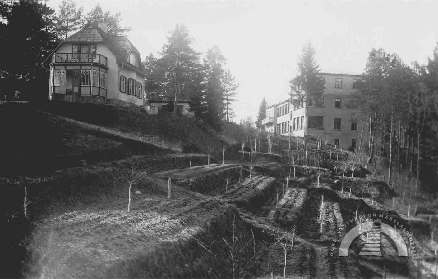
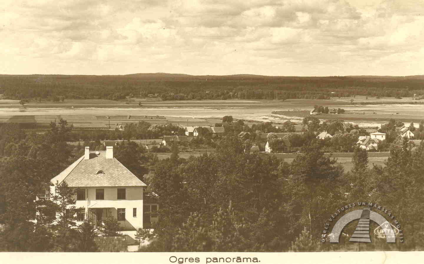
The former sanatorium “Saulstari” was built on Kazaku Hill. It began operating in 1931 and was once surrounded by a well-maintained terraced walking garden (a separate article about sanatoriums is available on the museum’s website). The hill on whose slope the current Ogre open-air stage was built in 1967 is Bākas Hill, which in earlier times was also known as Kazaku Hill. In 1898, the Ikšķile forestry established a fire observation tower at the top of the hill, resembling a lighthouse. From the tower, the entire surroundings of Ogre were clearly visible, and there was also a forestry summer house with a croquet court nearby. In 1911, the tower was demolished. A new fire observation tower was later built on the Jaunogre side, in the Zilie Hills.
CENTRAL PART OF OGRE CITY
The Kangari hill ranges located in the very centre of the city are the Vilku Hills, while outside the city limits, in the forest along Turkalnes Street towards Ogre Cemetery, lie the Sērķīši Hills. According to eyewitness accounts, before the Ogre resort was established, this area was rather wild, and wolves could be heard howling there. The Sērķīši Hills got their name from the animals that once lived there. Perhaps they were hares, as another name for this hill range is Zaķu Hills (Hare Hills).
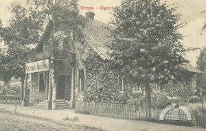
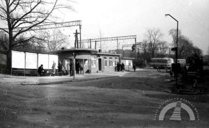
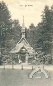
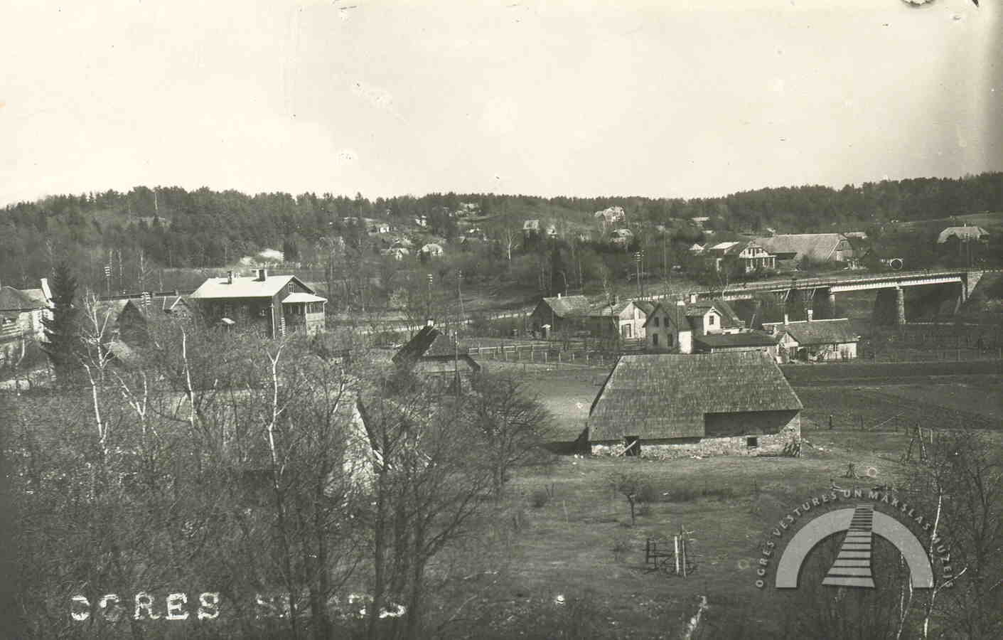
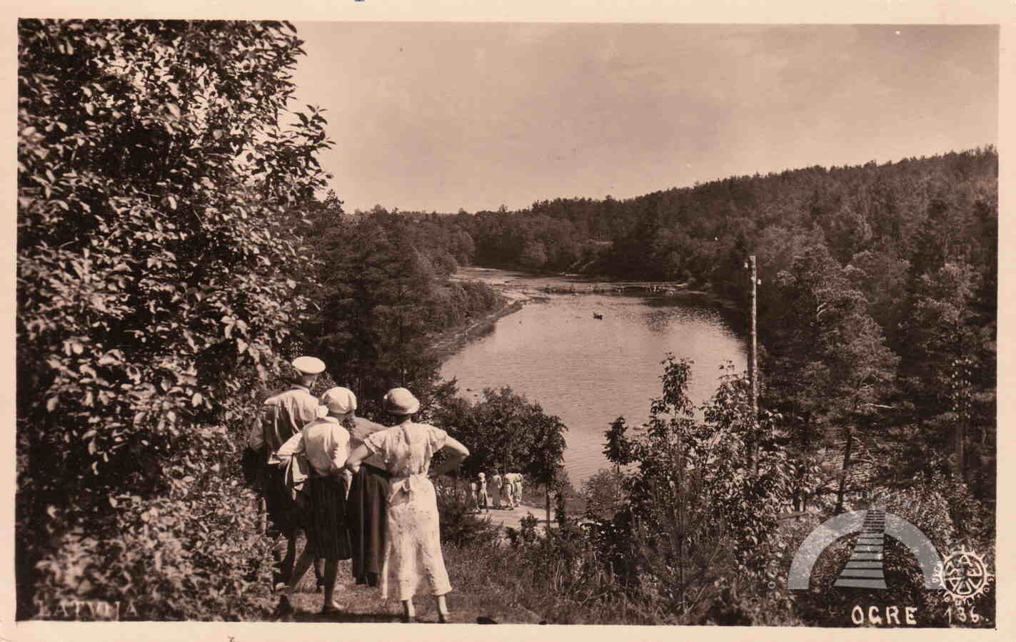
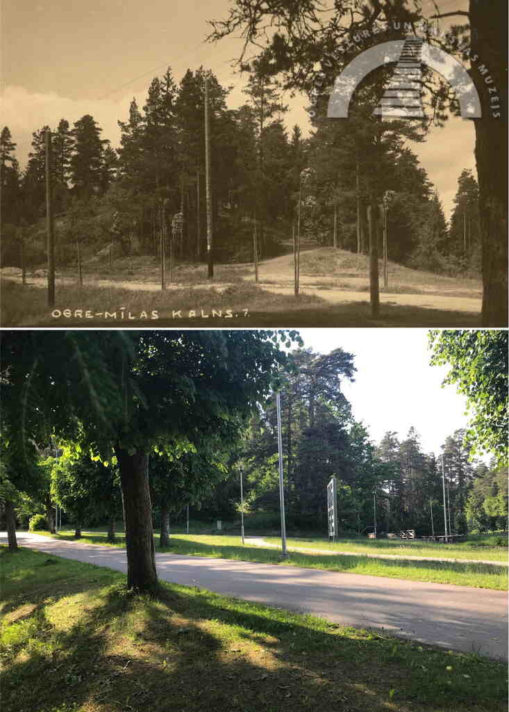
Between St Nicholas Orthodox Church and the Evangelical Lutheran Church of Ogre, on the bank of the Ogre River, is Mīlas Hill (Love Hill). At the foot of this hill, in what is now Krasta Square, one of the first social event venues – known as the Playground – was located at the end of the 19th century. Concerts, open-air dances, and other cultural events took place there. The hill was named Love Hill, possibly because it allowed couples to escape the everyday bustle for a romantic walk. In the 1920s–30s, Love Hill offered a wide view of the Ogre River footbridges and the swimming area, and it was also a popular photography spot.
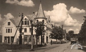
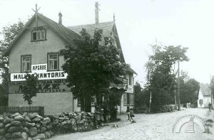
Skolas Hill (School Hill), where Ogre 1st Secondary School has been located since 1960, forms one of the largest elevations in the city centre. It was once called Krēģeris Hill because in the 19th century, H. Krēģeris, the caretaker of the Ogresparks villa colony, lived there. As many residents initially stayed in Ogre only during the warmer season, someone was needed to look after the summer houses during winter.
Near St Meinard’s Roman Catholic Church on Upes Prospekts is Slotiņkalns. It is gentle and wide and has been partially excavated and levelled over time. From 1861, a forestry was located there, and in the 1940s, a forestry school was established, later followed by a vocational technical school.
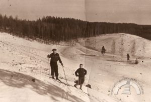
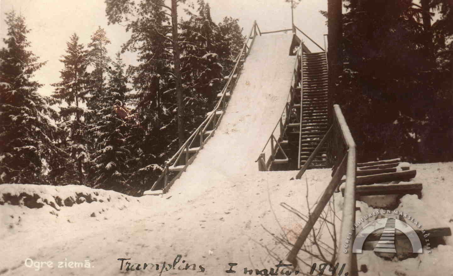
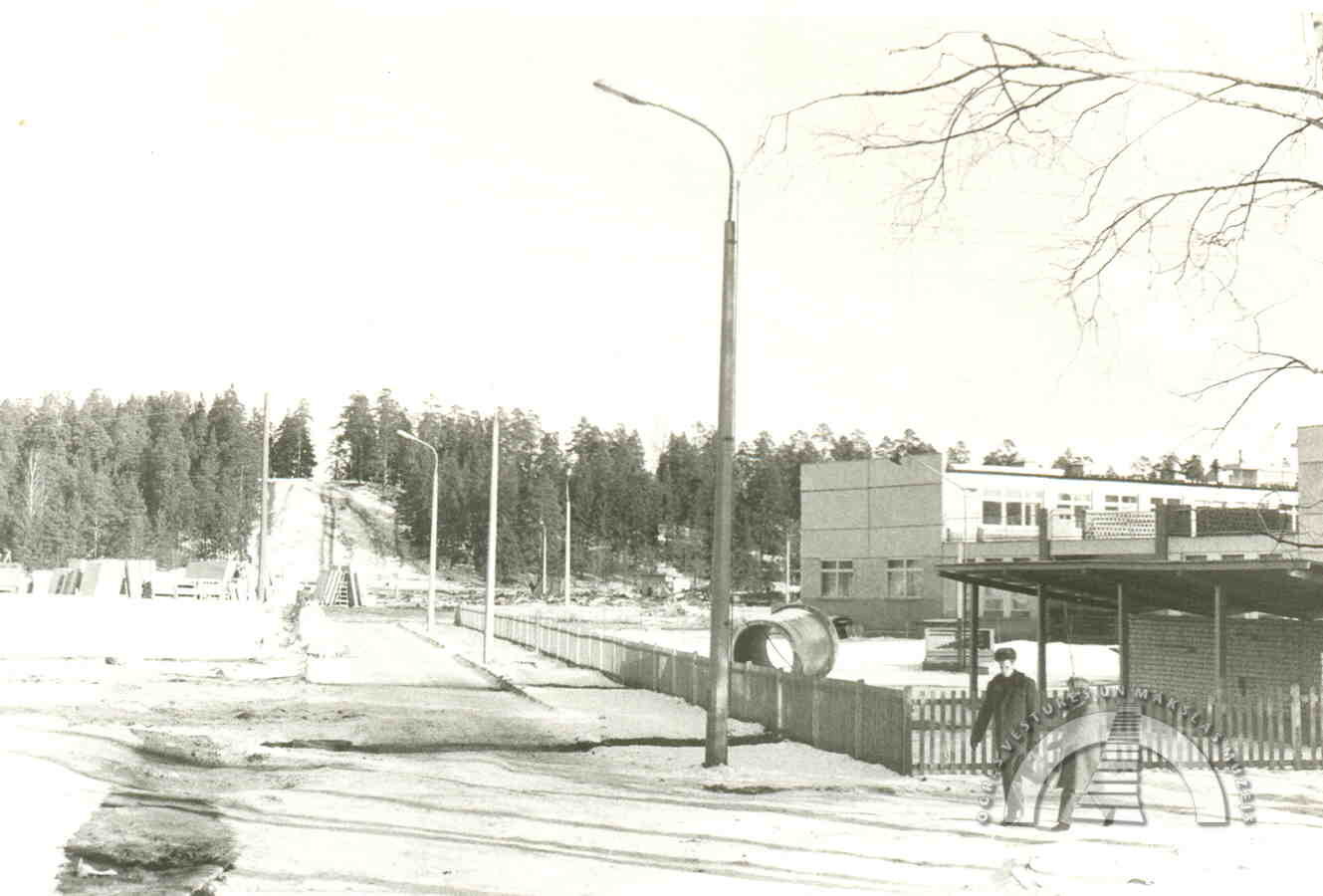
From the Vilku Hills to the Sērķīši Hills, one could travel by crossing Zvaigžņu Hill (Star Hill), walking along present-day Zvaigžņu Street, which connects the Ogre Music and Art School and Ogre State Gymnasium. The Sērķīši Hills were once one of the most popular places for skiers, and there was also a luge track there. Today, a sports complex and a ski jumping hill are gradually being developed in the Sērķīši Hills.
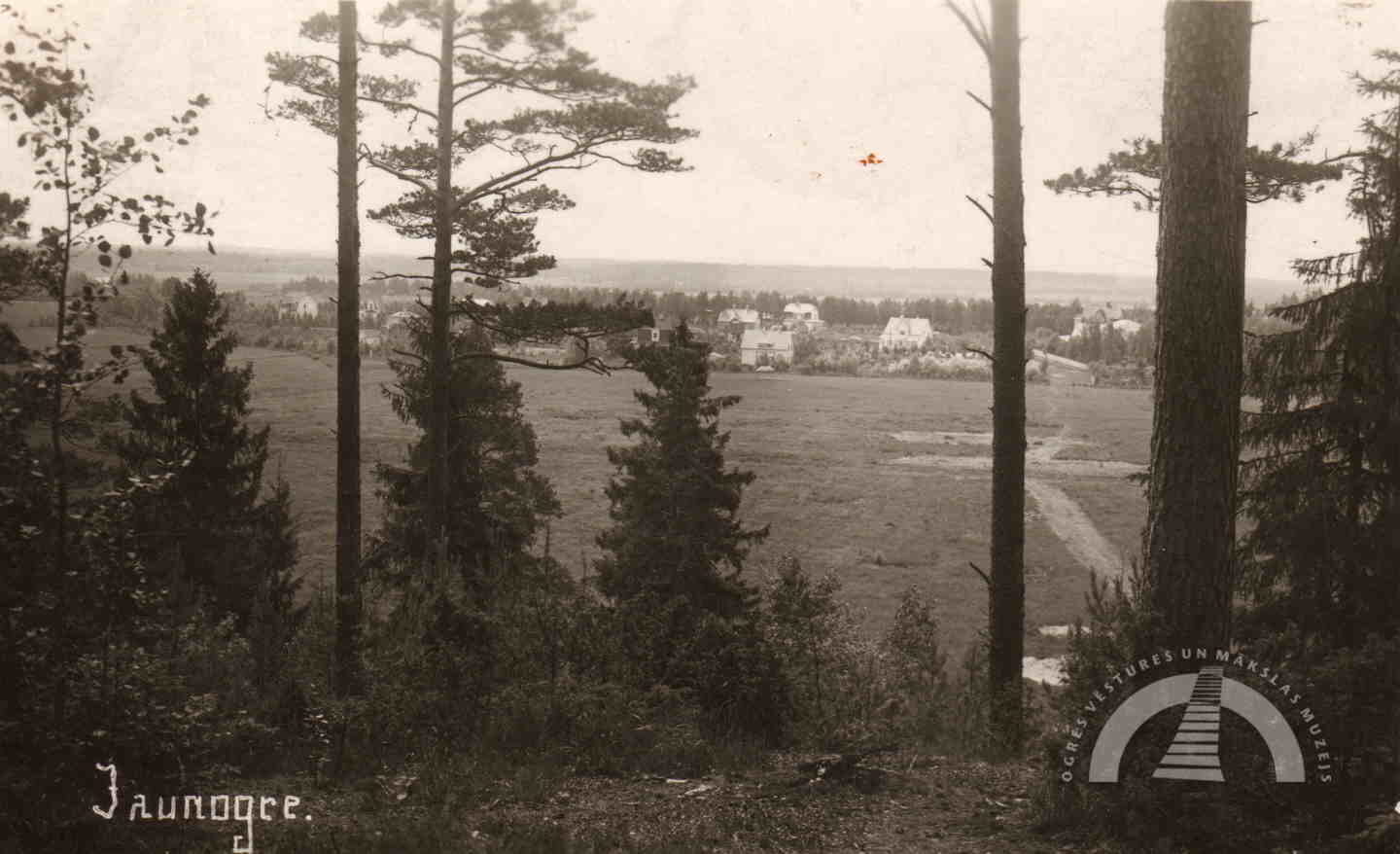
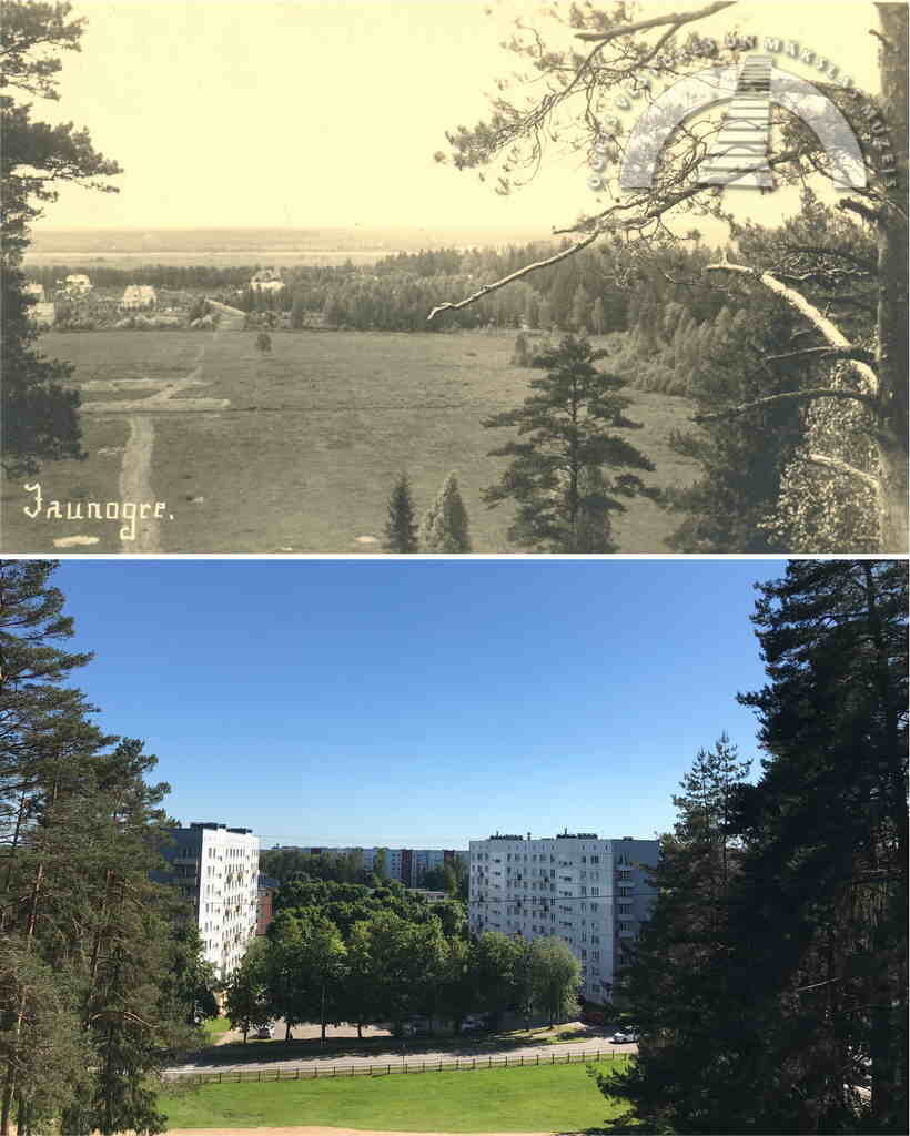
JAUNOGRE HILLS
The origin of the name Zilie Hills (Blue Hills) can be found both in the legend of a giant who smoked blue smoke and in more down-to-earth observations – the heather cover in the Zilie Hills was once richer than it is today, and the hills appeared bluer. Today, the Zilie Hills are part of the nature park “Ogres Zilie kalni”.
In Ernests Brastiņš’s 1930 publication Latvian Hillforts in Vidzeme, alongside Ķentes Hillfort, Zilais Hill (Blue Hill) is also described. It is now marked on maps as Skatu Hill (View Hill) and was located opposite the current Zilokalnu Prospekts. The nature of this hillfort’s fortifications and its thin cultural layer suggest that it was used only for a relatively short period. The hill’s plateau once served as a road to Tīnūži. During World War II, trenches were dug there, and in 1960 a motocross track was established in this area. All of this significantly damaged the ancient site, but small artificial elevations have survived to this day. Shortly before World War I, a fire observation tower relocated from Pārogre stood on the hillfort site, which is why the hill was for a time called Bākas Hill (Lighthouse Hill). Today, the “travelling” Bākas Hill (and the firefighters’ observation tower) is located between Tīnūži and Ogre, near the highway. On the south-eastern slope of the former hillfort, a modern ski jump was opened in 1934, but it was later demolished at the request of monument protection authorities.
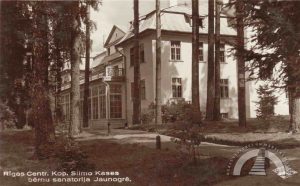
The foothills of the Zilie Hills on the Jaunogre side were once called Mālukalns (Clay Hill). In 1927, a sanatorium for children was built there, and its original name, “Mālkalne”, is preserved in the name of Jaunogre’s central street – Mālkalnes Prospekts. The clay has since been excavated for economic needs, and in place of the former marshy meadows and clayey hills there is now a residential area built by the “Ogre” Knitwear Factory.
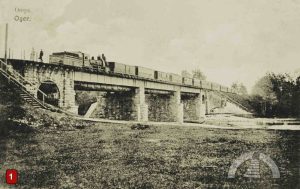
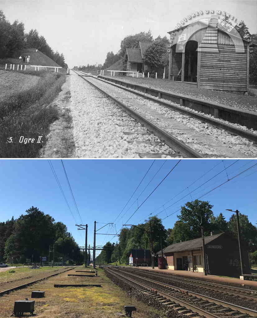
A little further from the Zilie Hills, near Jaunogre railway station, is a large mound called Saules Hill (Sun Hill). It was cut in half during the construction of the railway tracks. In earlier times, before development became so dense, this hill offered a wide view of the Ogre River’s confluence with the Daugava. Saules Hill is also part of the Ogre Kangari range – a reminder of the ancient glacier that once shaped this landscape.
“OGRE KANGARI” HIKING TRAIL
We invite you to explore the hiking trail to better discover the hills of Ogre. View the photo gallery and read the story on the museum's website or Facebook page. By looking at historical images, you can compare how the city has changed over time. We have marked the route in the "BalticMaps" map browser. The “GPX” file is convenient to use with the LVM GEO mobile app. The total length of the hiking trail marked on the map is 14 kilometers (7 kilometers in Pārogre and 7 kilometers in Ogre center and Jaunogre). The hiking trail winds through both the urban part of the city (with asphalt, cobblestone, and gravel surfaces) and green areas (park paths and pedestrian-trodden forest trails without special amenities).