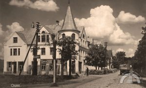
OGRE RIVER AND BRIDGES
As spring begins, the museum invites you to take educational walks and explore the Ogre River and its bridges, each shaped by historical events. The city of Ogre is defined by its rivers – Daugava and Ogre. Smaller rivers also flow through the city: Norupīte, Urga, and Lebiņa. As the city developed, some of these […]
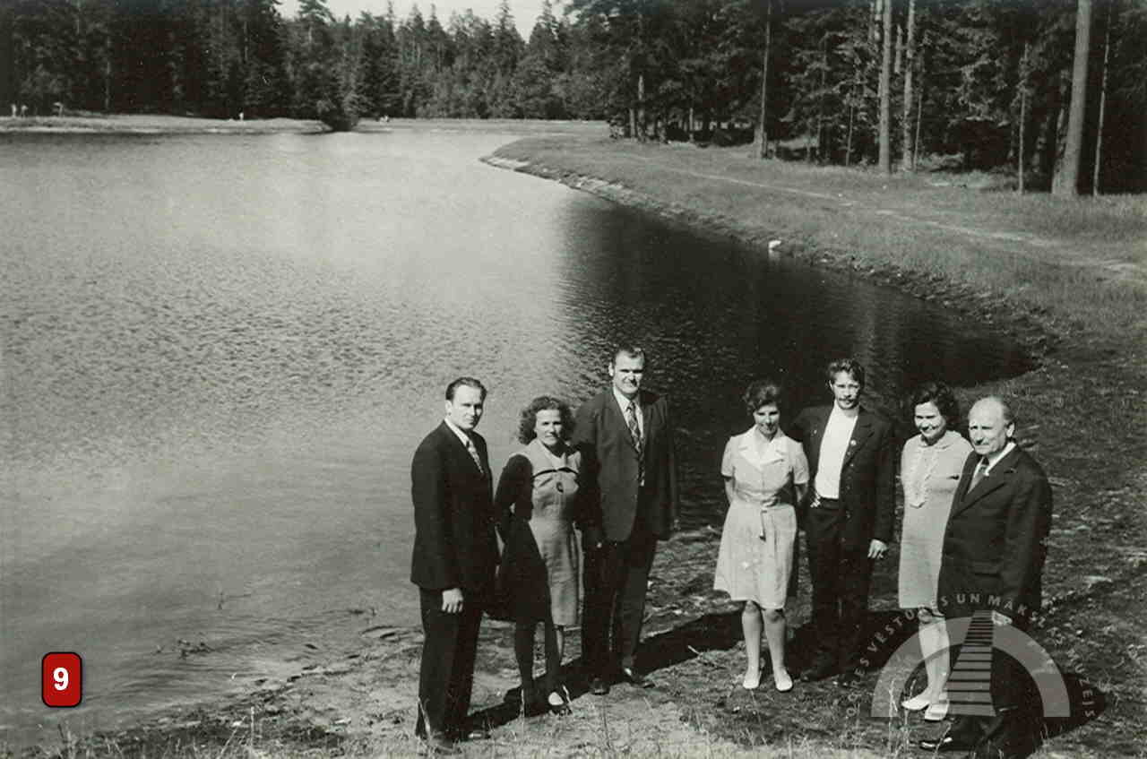
As spring begins, the museum invites you to take educational walks and explore the Ogre River and its bridges, each shaped by historical events.
The city of Ogre is defined by its rivers – Daugava and Ogre. Smaller rivers also flow through the city: Norupīte, Urga, and Lebiņa. As the city developed, some of these smaller rivers were diverted underground or disappeared within private properties. The Daugava and the Ogre have also changed their appearance and course over time. But how exactly has this happened? The Ogre History and Art Museum offers a brief insight into the history of the city’s rivers and bridges, with illustrations that help to understand how today’s city has developed.
OGRE RIVER CROSSING IN THE PAST
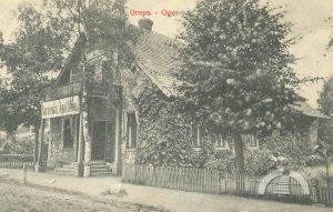
Initially, people and carts crossed the Ogre River via light seasonal wooden bridges. The ancient trade route along the Daugava had no permanent or substantial bridge until the beginning of the 20th century. At the confluence of the Ogre and Daugava rivers, a wooden bridge was built every year from spring to autumn. It was constructed annually by peasants as corvée labour, in return for which they could cross the bridge free of charge. During floods, a ferryman operated instead.
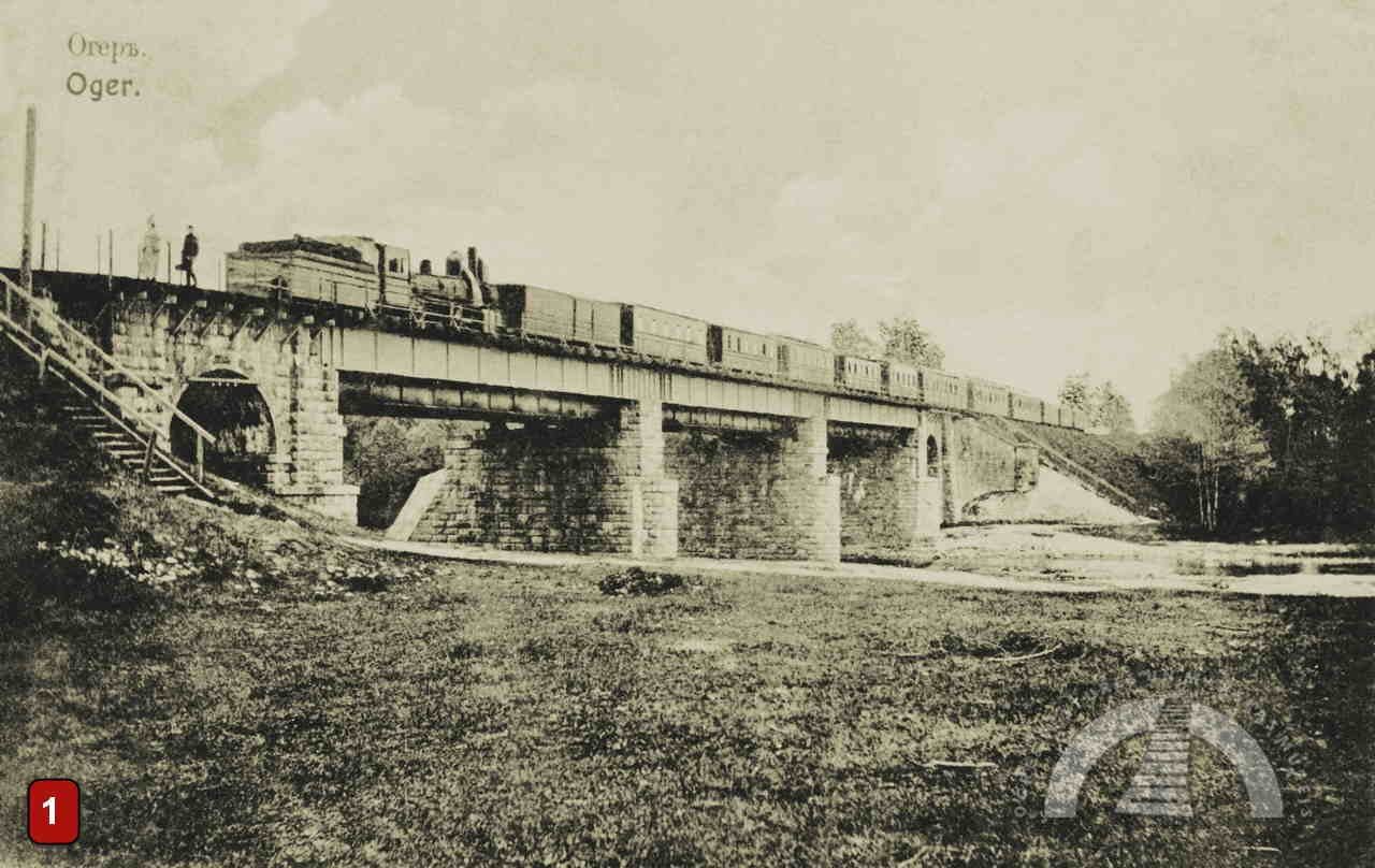
RAILWAY AND RAILWAY BRIDGE
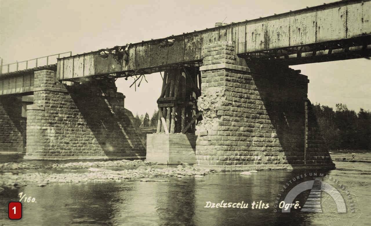
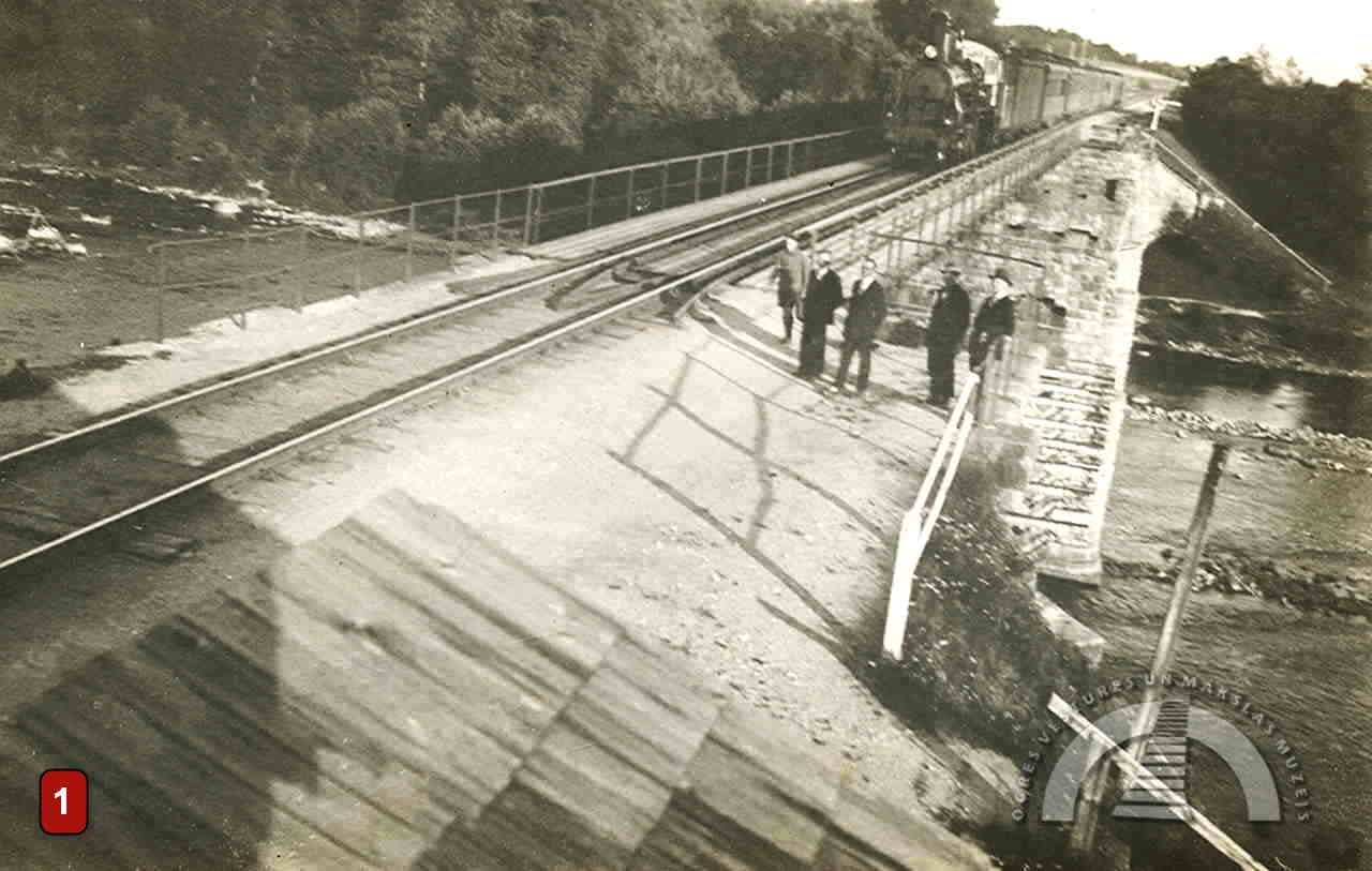
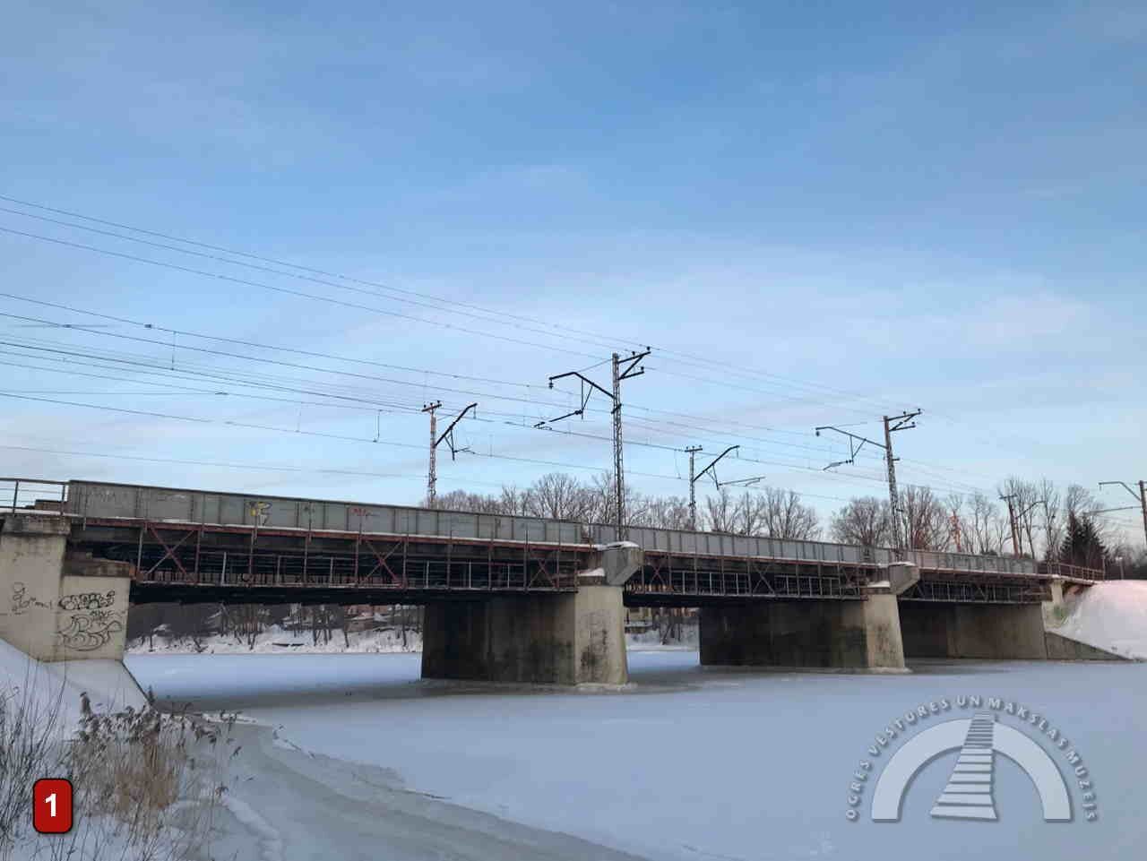
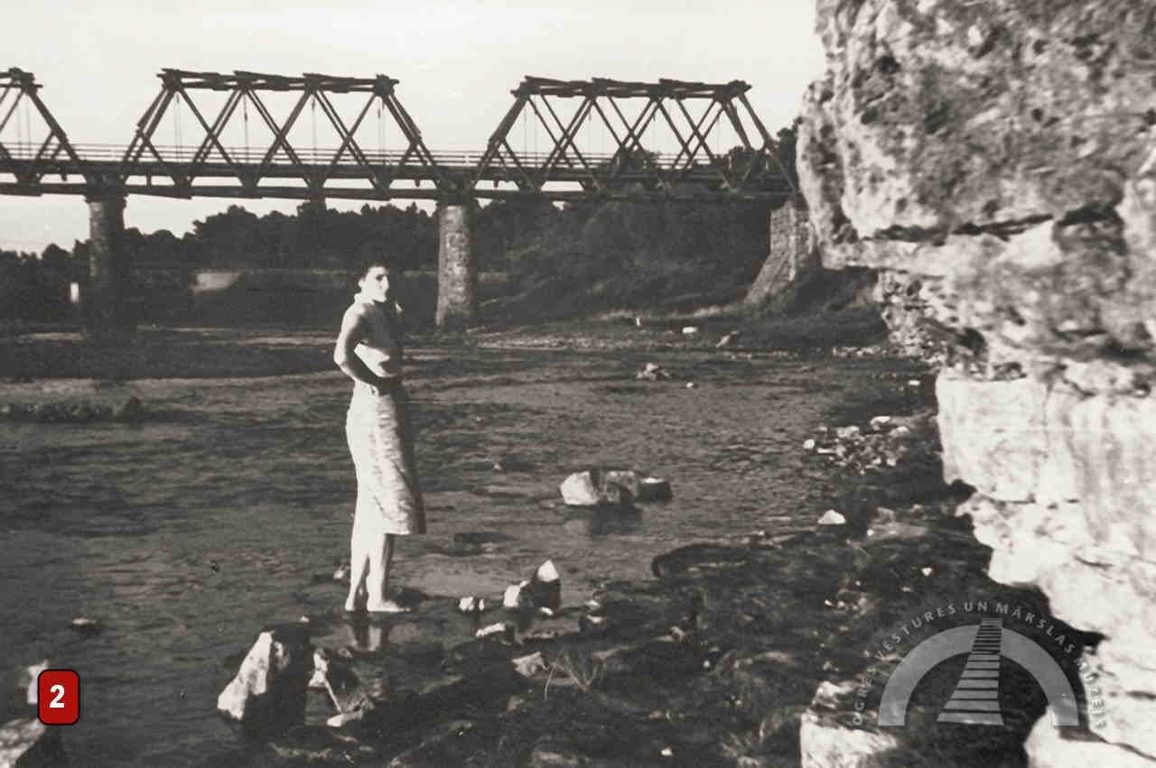
The Ogre railway bridge is the oldest in the city. It was built in 1861, and the establishment of the railway line created the opportunity to develop Ogre as a resort. The original railway bridge looked very different from today’s structure. It had iron beams and lattice trusses as load-bearing elements. At the end of the 19th century, the bridge was rebuilt to withstand heavier loads.
The bridge was damaged during World War I but was later restored. In 1944, the German army blew it up during its retreat, and a new railway bridge was constructed. The last major reconstruction took place in 1970, when the bridge was adapted for two-way train traffic.
HIGHWAY BRIDGE
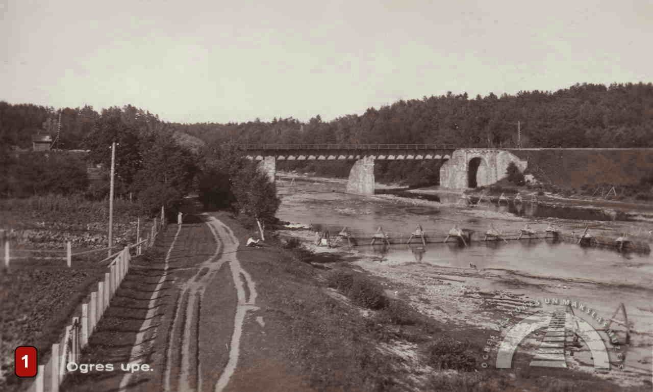
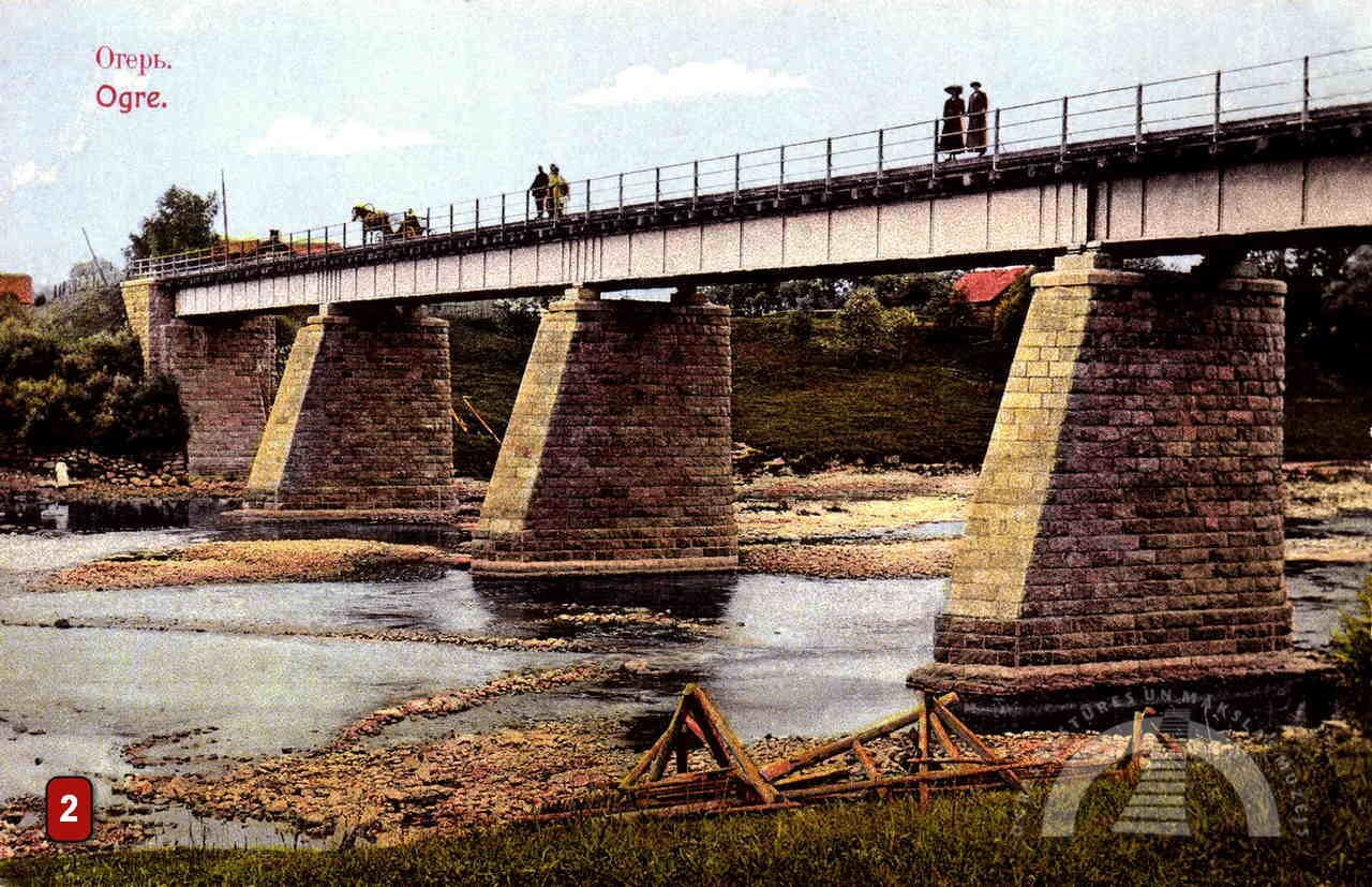
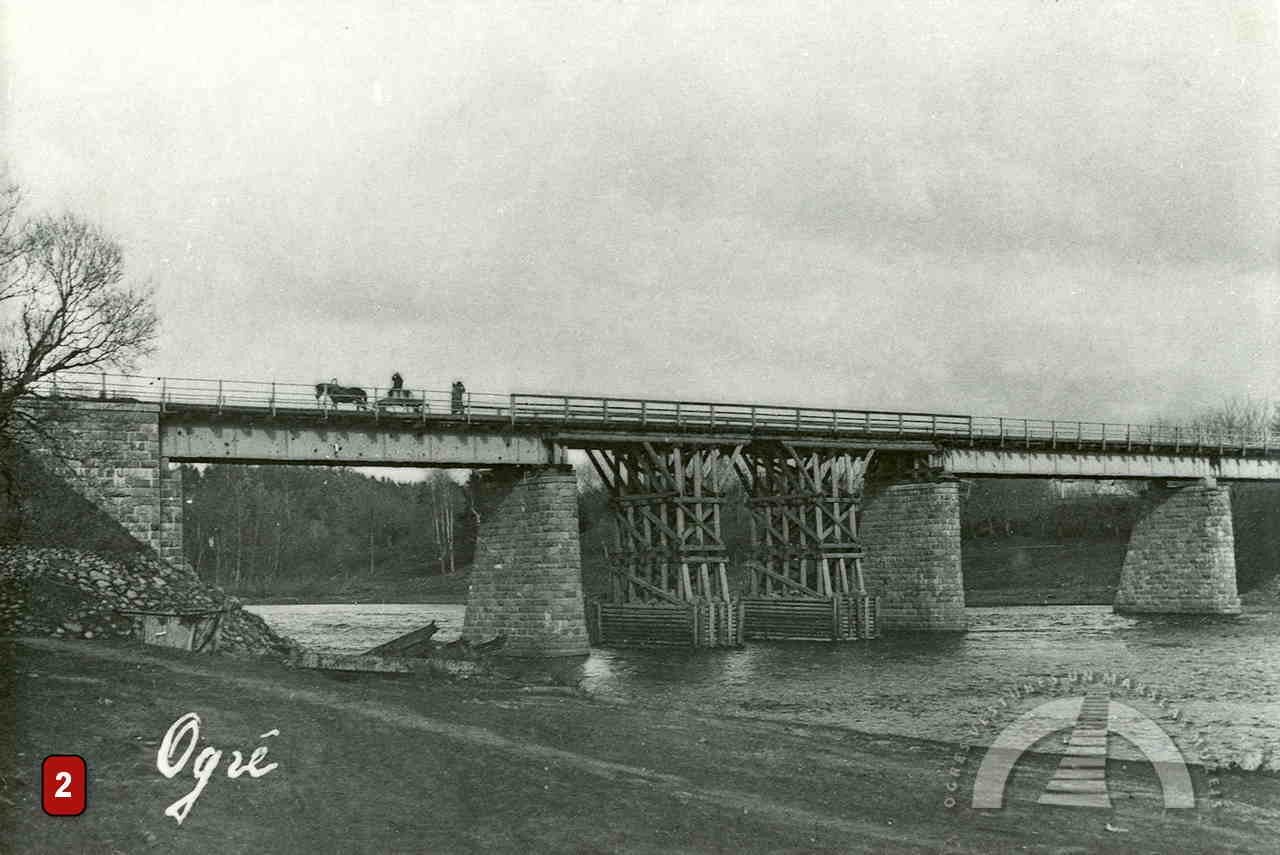
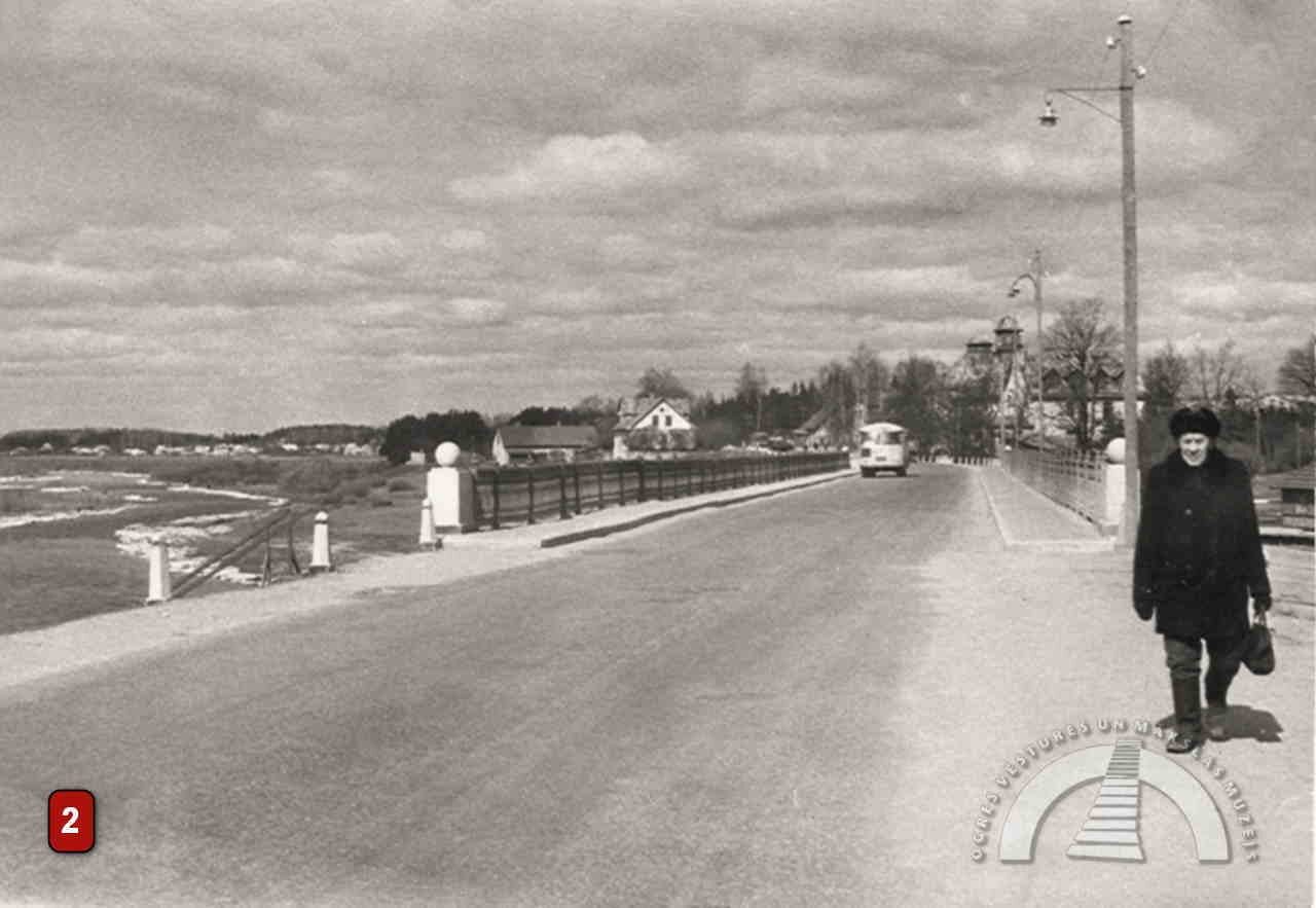
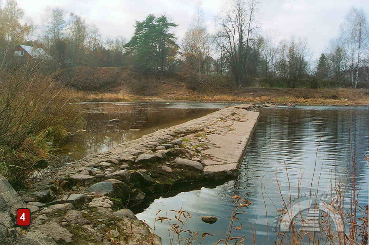
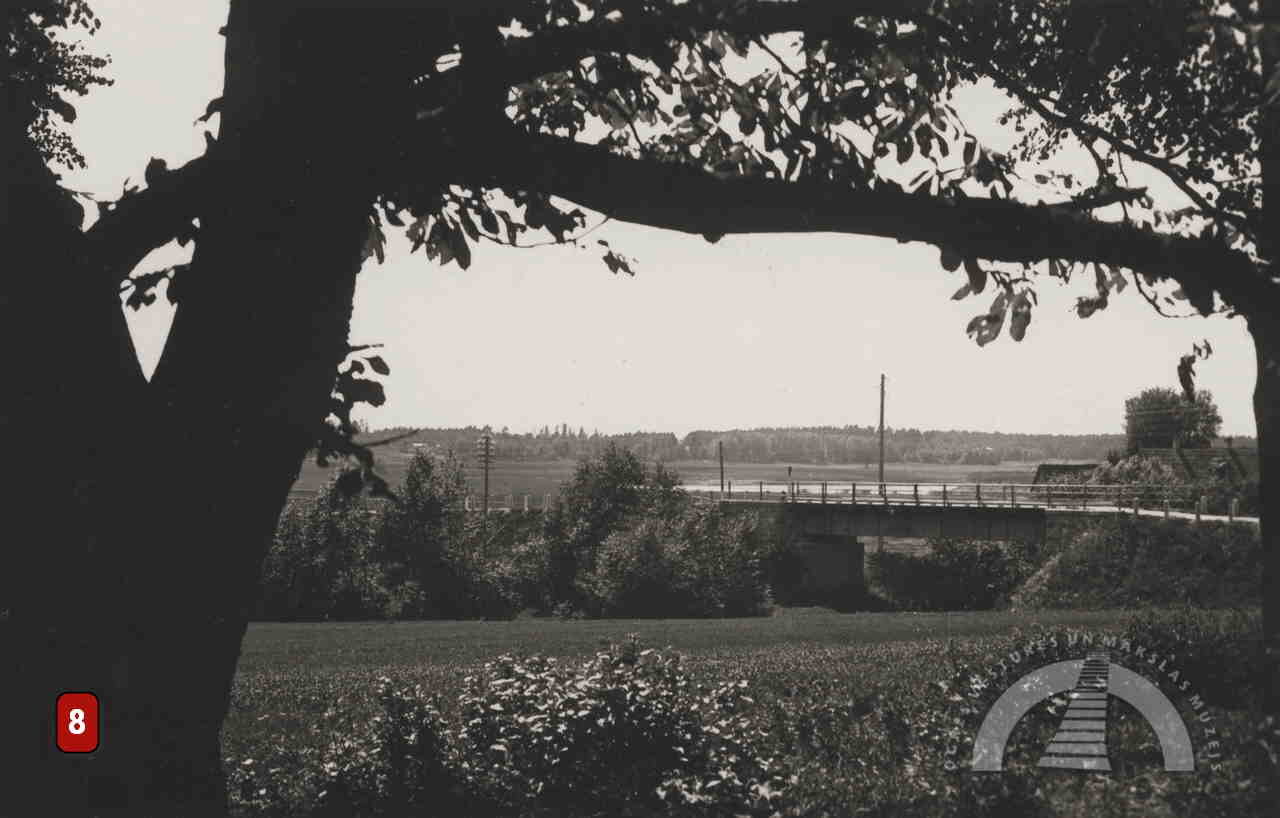
The second-oldest bridge was built in 1907. It was 89 metres long, with four-span riveted plate-girder metal beams. It rested on three river piers and two masonry abutments on the banks. This bridge was partially blown up during World War I, then restored, but blown up again during World War II.
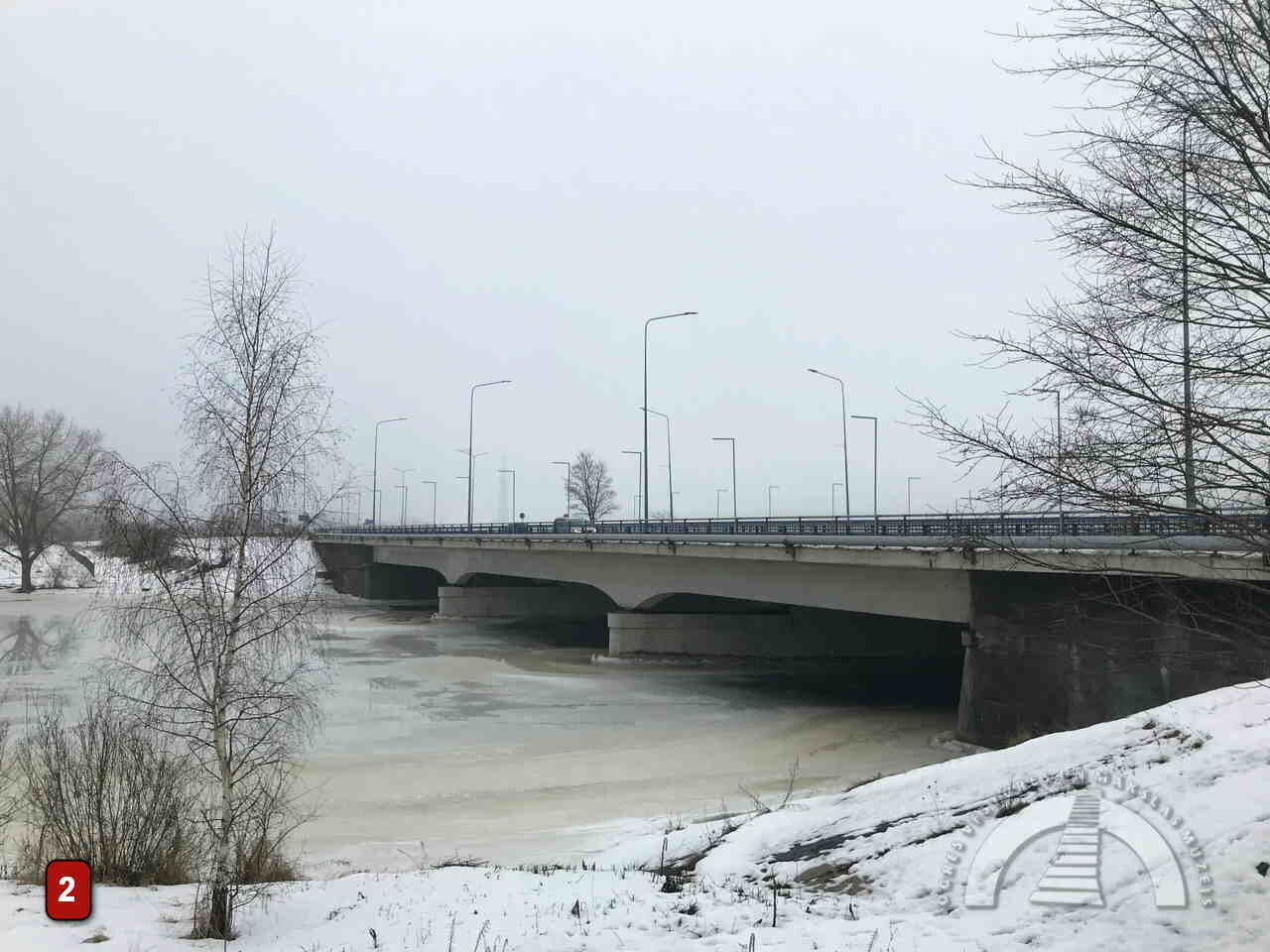
Afterwards, a wooden bridge was installed on the old supports. It served for some time, but in the 1950s the structure was dismantled because it no longer met safety standards. In 1956, when the new Riga–Daugavpils highway was built, a new reinforced concrete bridge was constructed closer to Ogre Island, at the site of the current bridge. For a long time afterwards, the foundations of the old bridge remained visible. Since the 1990s, a city overpass has stood on the foundations of the oldest bridge, and it also serves pedestrians.
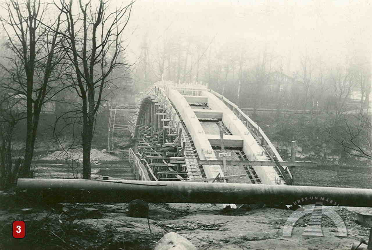
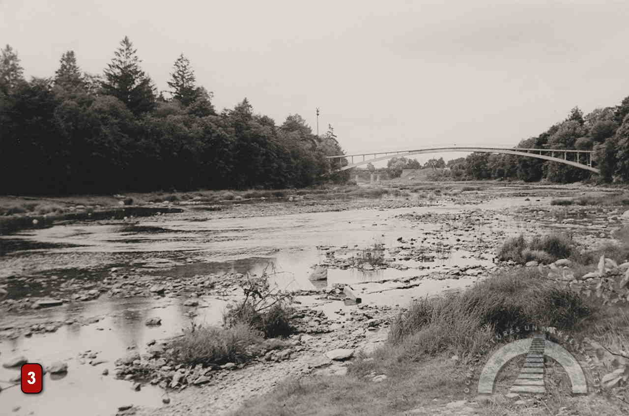
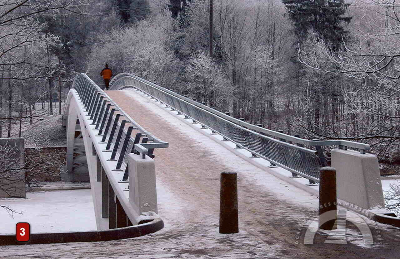
PEDESTRIAN BRIDGES
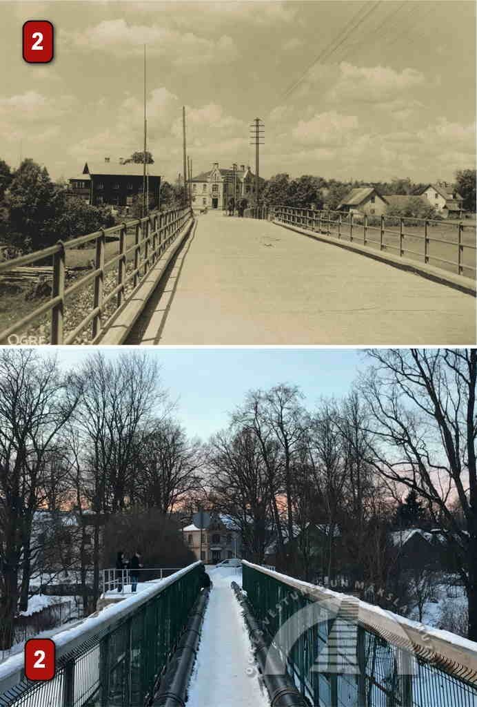
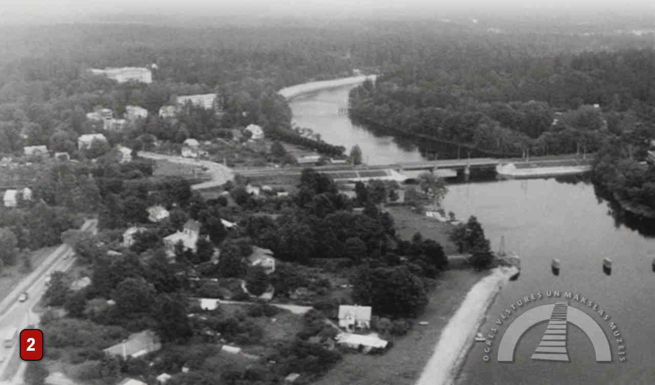
In 1966, the now well-known arched pedestrian bridge was built. It is 96.2 metres long, with an 83-metre arch span, and was designed by Ogre resident Voldemārs Salcevičs.
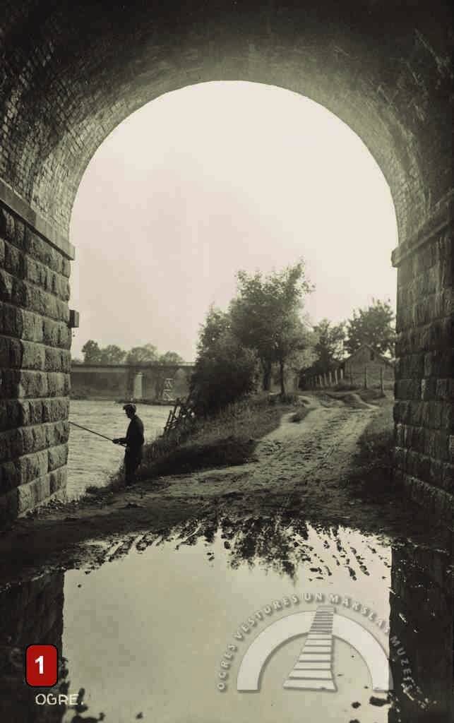
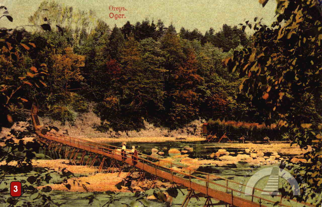
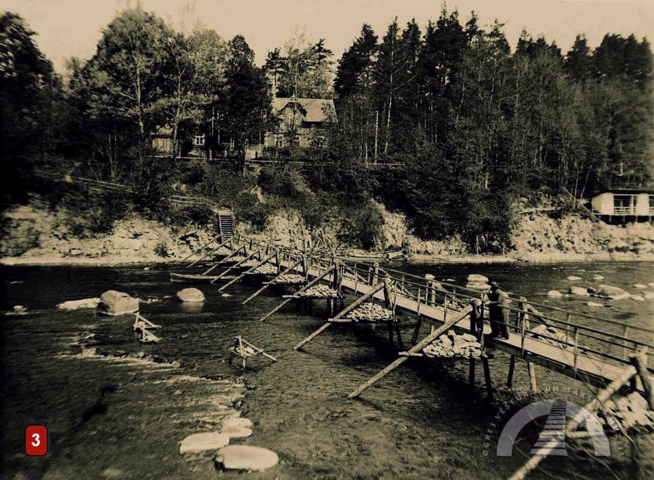
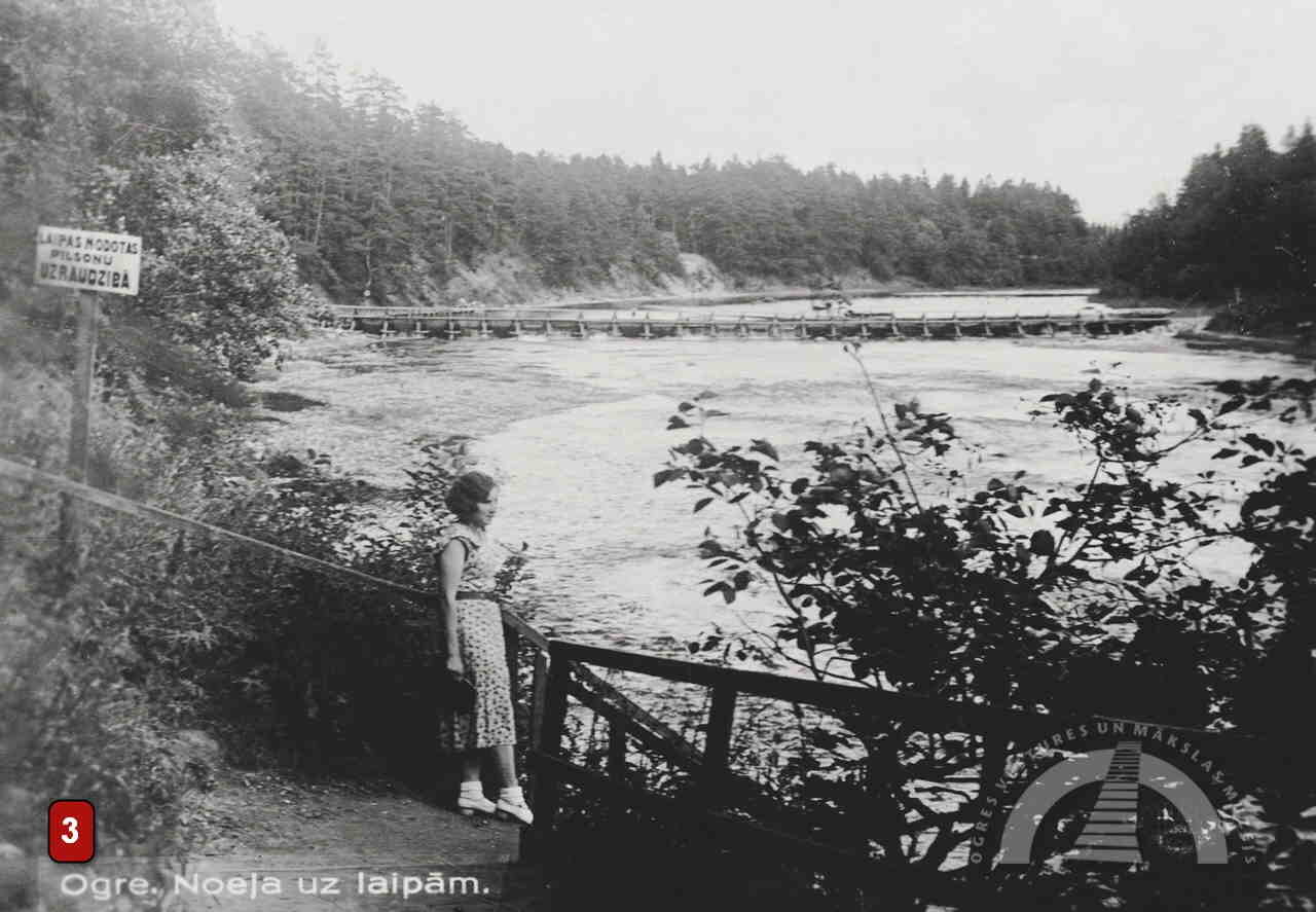
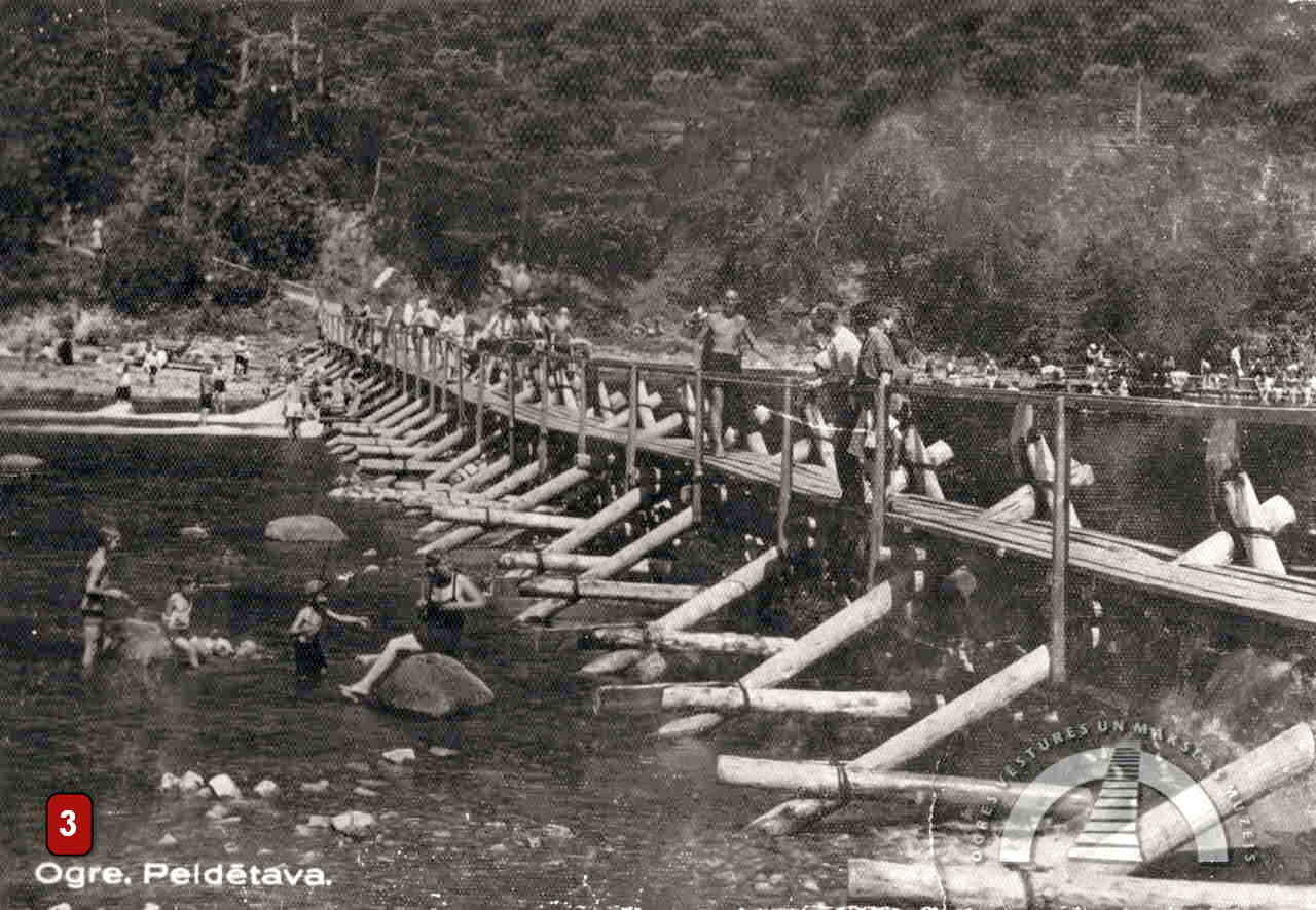
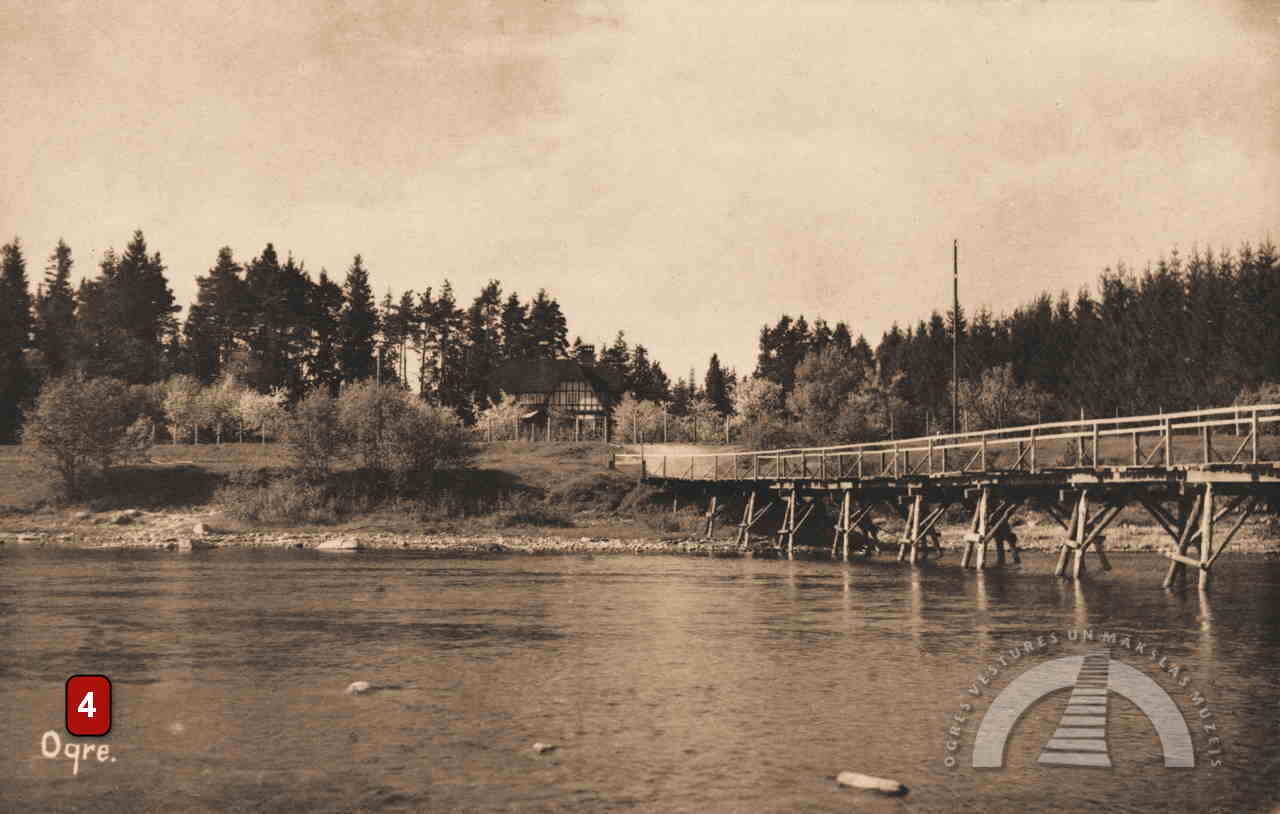
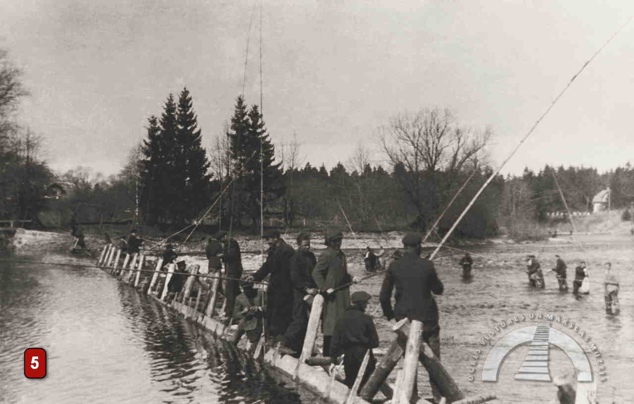
Before that, pedestrians crossed the river on light wooden walkways, which were dismantled seasonally. The hard dolomite riverbed of the Ogre River made it difficult to drive piles into the ground, so the walkways were placed on wooden trestles weighted down with stones. These crossings were located in several places – opposite Birch Alley, opposite the present Orthodox church, and opposite the Lutheran church.
The wooden walkways were once among the city’s most distinctive features and attracted visitors from Riga and elsewhere. On the riverbank opposite Krasta Street, there was a well-equipped swimming area. In the 1930s, it included hydro-massage facilities and various sports opportunities.
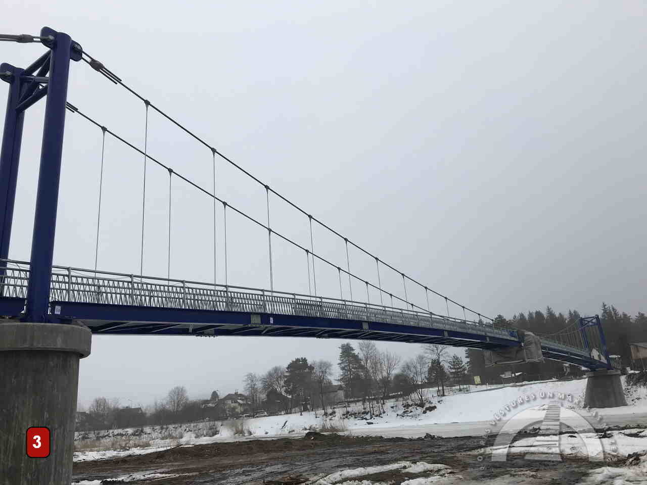
Since 2017, a seasonal pontoon bridge has revived this historic river-crossing tradition. Currently, another pedestrian bridge is under construction, which will connect the banks of the Ogre River between Ogre Street and J. Čakste Avenue.
DAMS
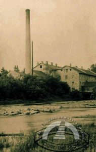
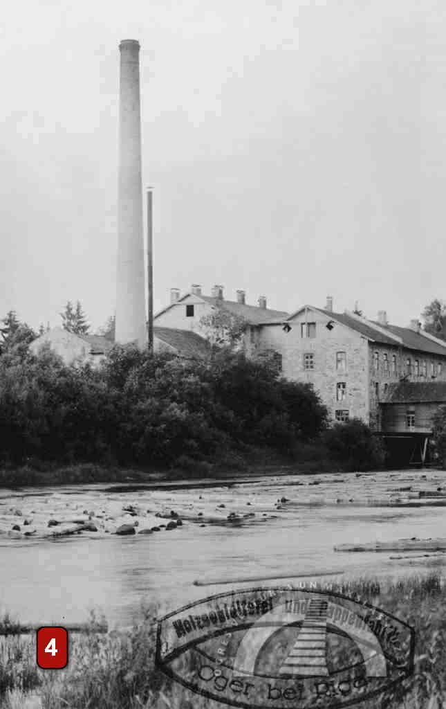
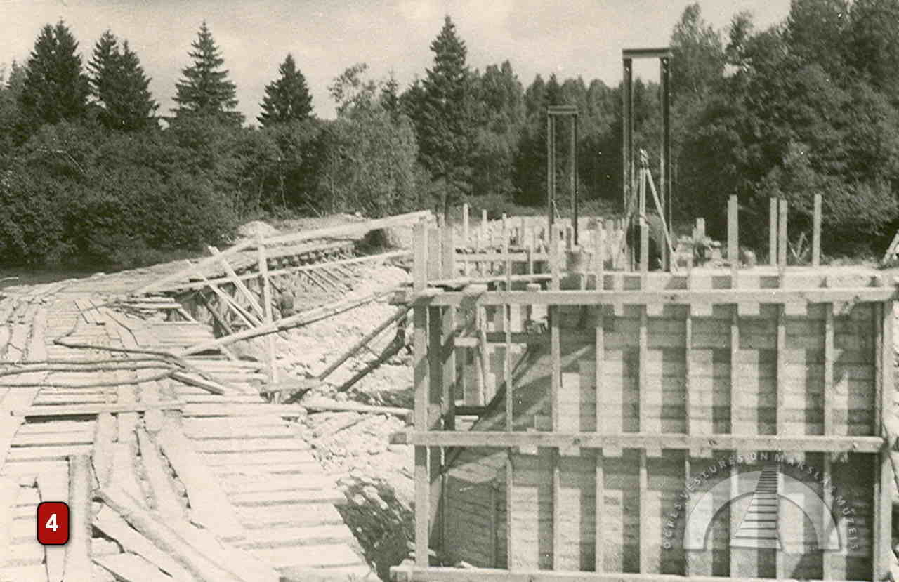
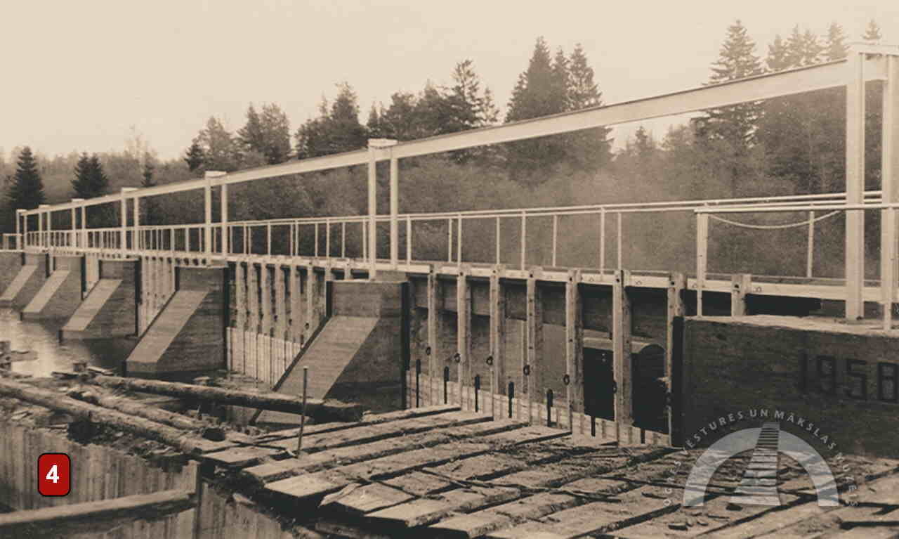
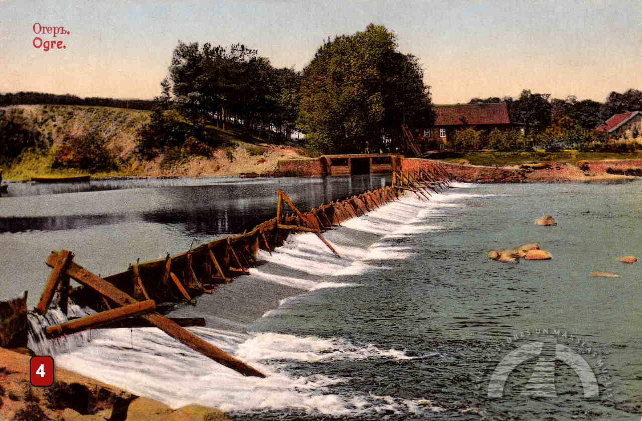
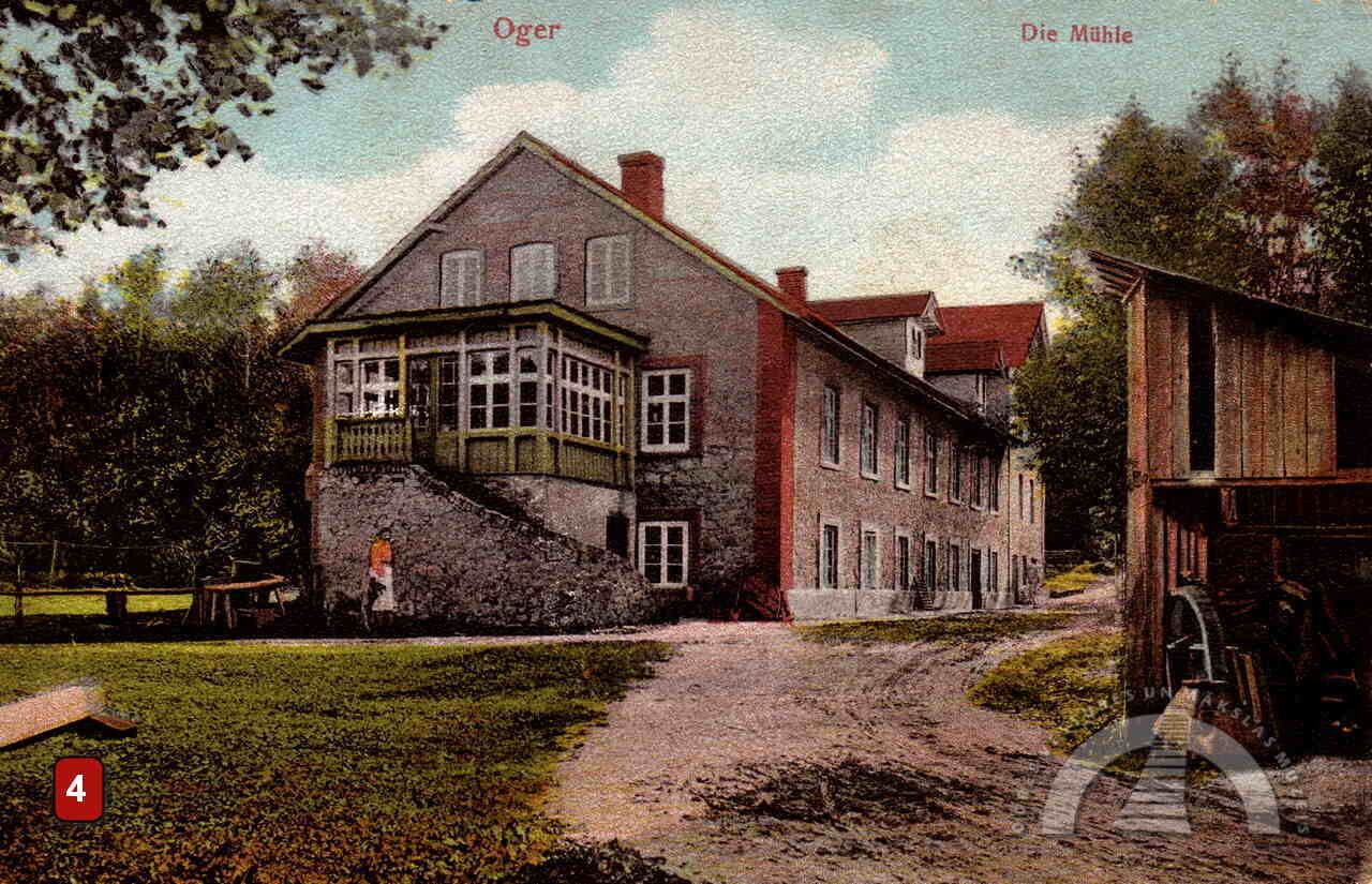
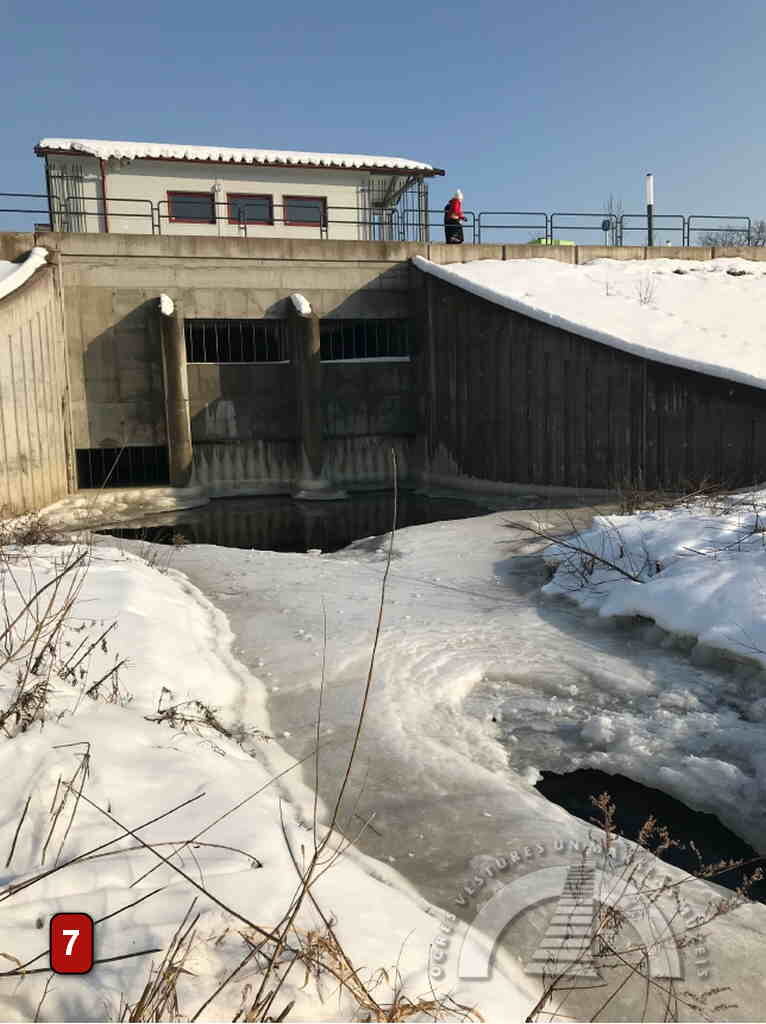
The dam near the former cardboard factory (later the Carton Factory) was built at the end of the 19th century as a gravel embankment reinforced with wooden trestles and topped with concrete. The current concrete dam with a pedestrian crossing was built in 1958. Over time, the river’s power at this location has driven mills for the factory’s needs and now powers the turbines of a hydroelectric power plant.
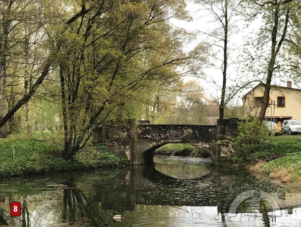
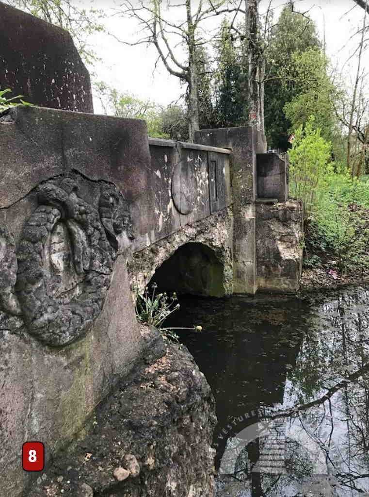
Mills with a dam were also located on the left bank of the Ogre River, opposite the confluence with Norupīte. A light wooden bridge allowed carts to reach the mills. These mills operated until World War II and were used for grinding flour.
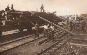
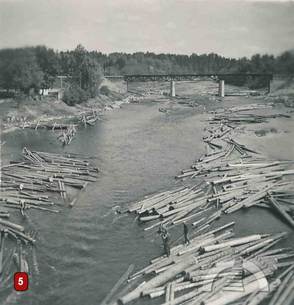
RAFTS AND FISH
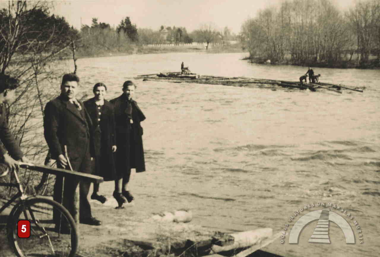
Until 1964, the Ogre River was used for transporting timber to Riga during floods. However, each newly built bridge made log rafting increasingly risky. In the late 20th century, logs were floated individually, and rafts were assembled at the river mouth behind the railway bridge.
Before the construction of the Riga Hydroelectric Power Plant, the Ogre River was much richer in fish. Fishing was an important source of livelihood for residents. The river was abundant in vimba, perch, and lamprey, and lamprey weirs once stood along the river.
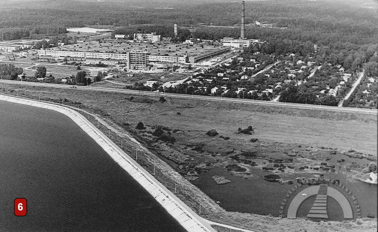
RIGA HES AND OGRE RIVER
With the construction of the Riga Hydroelectric Power Plant in the 1970s, the water level in the Ogre River rose by 2–3 metres. The once fast-flowing river significantly changed its character.
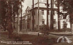
In 1972, the 1,300-tonne highway bridge was raised by 2.2 metres using hydraulic jacks. Protective icebreakers were built at the supports of the arched pedestrian bridge. Swimming areas had to be re-established, and the rising water level also affected fish populations, destroying spawning grounds. One of the two outlets of the Ogre River (on the Jaunogre side) was eliminated by the construction of a dam. Today, the so-called Frog Pond is located in the former bed of this right-hand outlet.
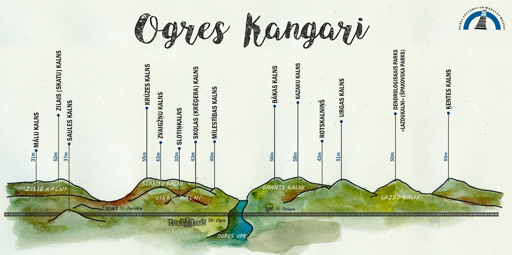
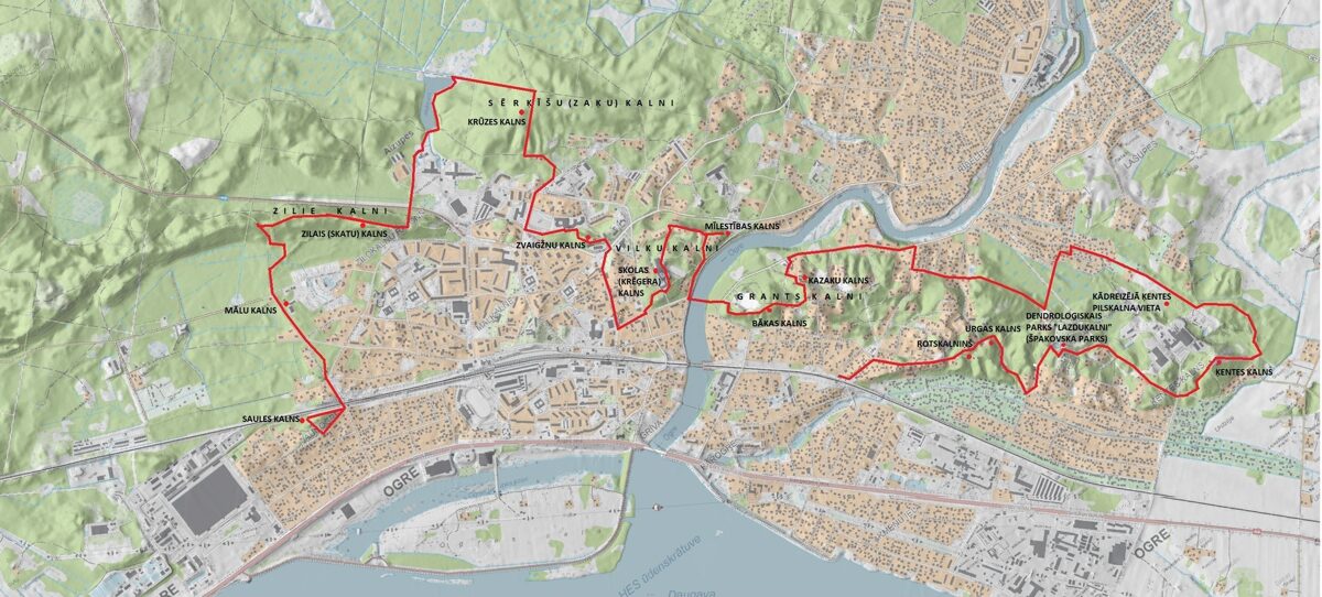
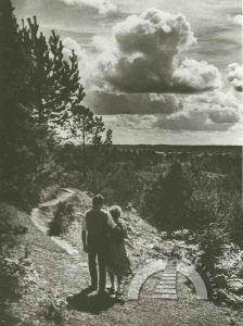
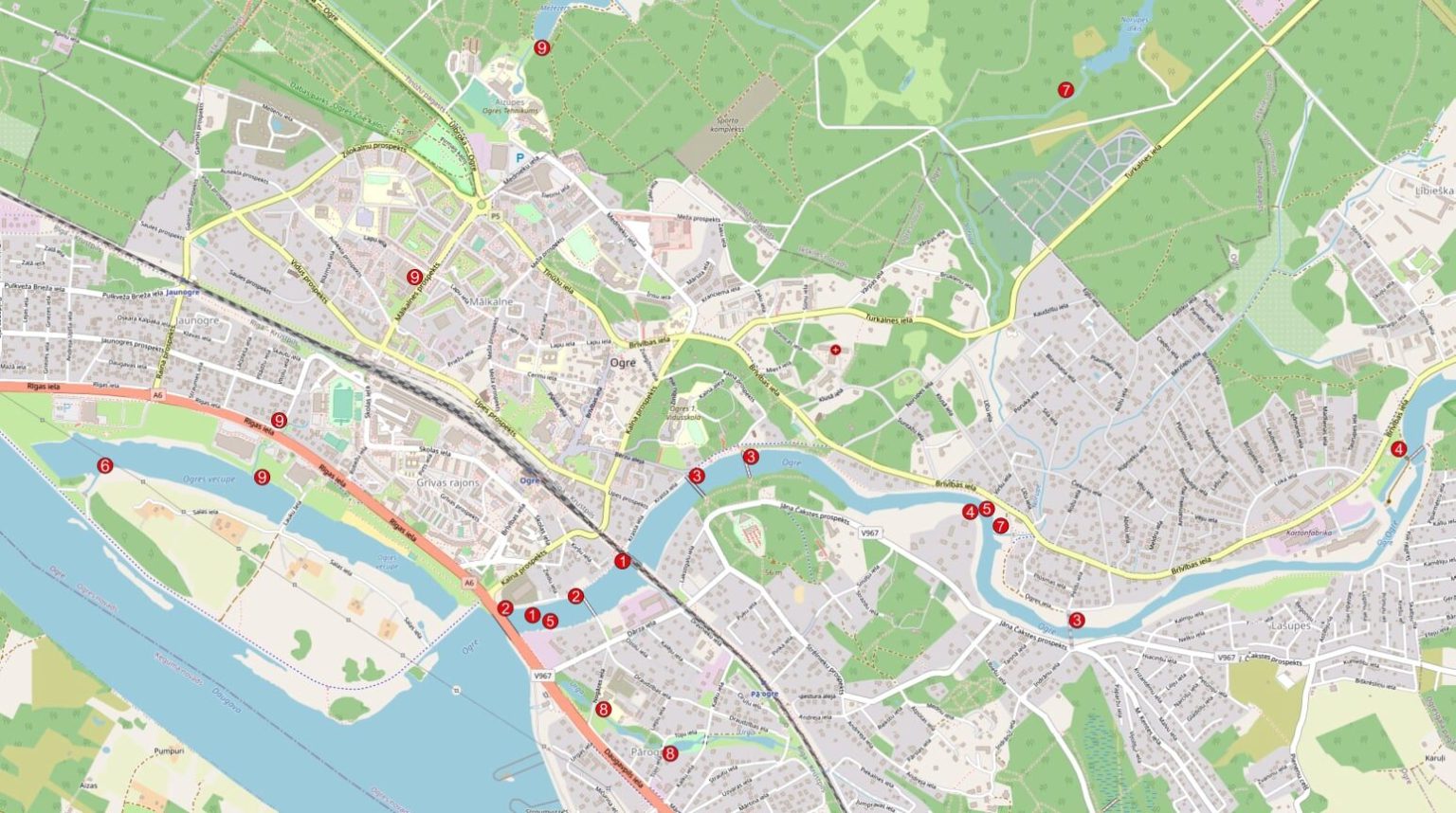
“OGRE KANGARI” HIKING TRAIL
We invite you to explore the hiking trail to better discover the hills of Ogre. View the photo gallery and read the story on the museum's website or Facebook page. By looking at historical images, you can compare how the city has changed over time. We have marked the route in the "BalticMaps" map browser. The “GPX” file is convenient to use with the LVM GEO mobile app. The total length of the hiking trail marked on the map is 14 kilometers (7 kilometers in Pārogre and 7 kilometers in Ogre center and Jaunogre). The hiking trail winds through both the urban part of the city (with asphalt, cobblestone, and gravel surfaces) and green areas (park paths and pedestrian-trodden forest trails without special amenities).